

Tropical Storm Rina develops in busy Atlantic as nearby Tropical Storm Philippe maintains strength
The Atlantic Basin is still buzzing with activity with the development of Tropical Storm Rina on Thursday morning, and forecasters are still keeping their eyes on Tropical Storm Philippe, which is maintaining strength as it spins just to the west of Rina – creating a challenging forecast for their tracks.
Here's a closer look at the active Atlantic Basin on Thursday, Sept. 28, 2023.
Tropical Storm Rina

Tropical Storm Rina's stats. (FOX Weather)
The system had been dubbed Invest 91L for several days before it was upgraded to a tropical storm on Thursday.
The National Hurricane Center (NHC) says Tropical Storm Rina is moving to the north-northwest at 10 mph and has maximum sustained winds of 40 mph with higher gusts.
The NHC says Rina is expected to experience some gradual strengthening over the next few days.
Rina is now the 18th named storm of the 2023 Atlantic hurricane season.
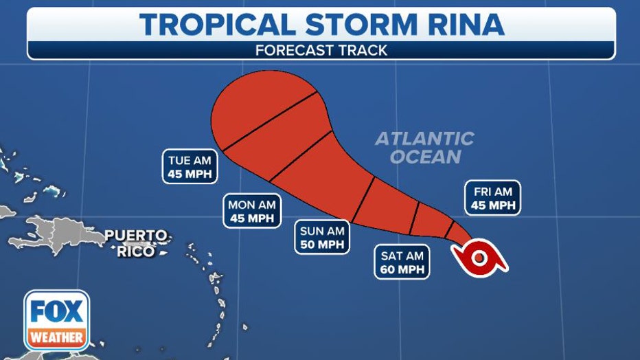
Tropical Storm Rina's forecast cone. (FOX Weather)
Tropical Storm Rina is expected to continue moving to the north-northwest before making a turn more westward later Thursday or Friday.
Tropical Storm Philippe
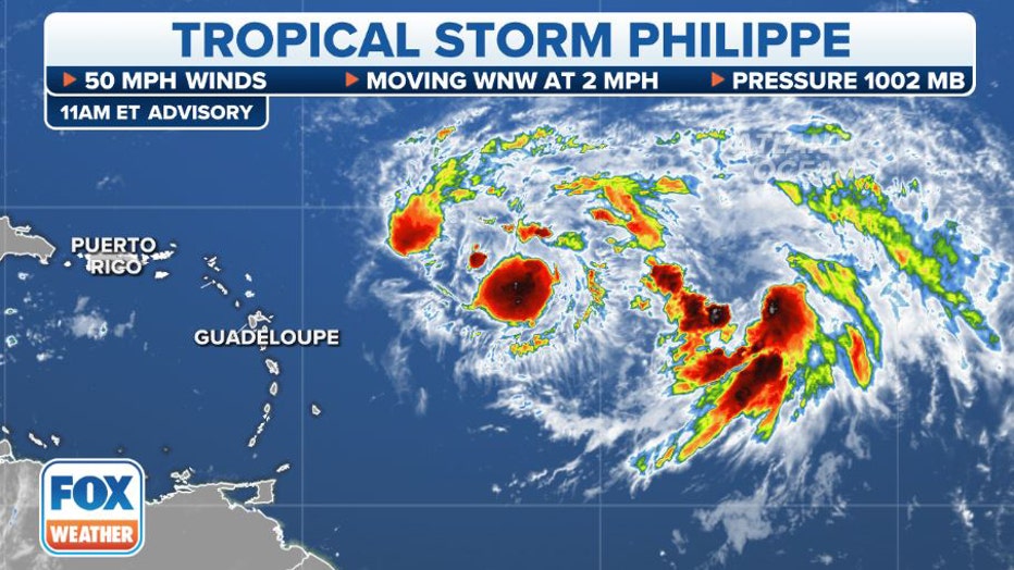
Tropical Storm Philippe's stats. (FOX Weather)
Tropical Storm Philippe has slowed to a near crawl just over 500 miles east of the northern Caribbean islands. Philippe's peak winds are still estimated at 50 mph, but it has reached its expected maximum intensity, according to the National Hurricane Center (NHC). Computer forecast models show the system could degenerate into a remnant low as early as Sunday, though there is low confidence in how slowly Philippe will weaken.
Also of low confidence: Philippe's future track. There are several complex atmospheric factors in play that will influence Philippe's future, including the fate of Tropical Storm Rina churning just behind Philippe.
"The fact that these two systems are so close to each other means that their possible interaction has to be considered. Whichever system can find a conducive patch of atmosphere might well become dominant and control the path of the other," says FOX Weather Hurricane Specialist Bryan Norcross. "The phenomenon of two systems affecting each other is called the Fujiwhara Effect or a binary interaction. They can also interact without disrupting each other's track by simply creating more hostile wind flow around and over the twin system."
BRYAN NORCROSS: TROPICAL STORMS PHILIPPE AND LIKELY-RINA BATTLE FOR SUPREMACY IN ATLANTIC
As of Thursday morning, the forecast track and cone of Philippe has the storm drifting to the west-southwest over the next few days, followed by a turn back to the northwest early next week, which could bring Philippe or its remnants near the northern Caribbean islands. But the storm could also feel the tug of Tropical Storm Rina behind it, complicating the forecast for both storms.
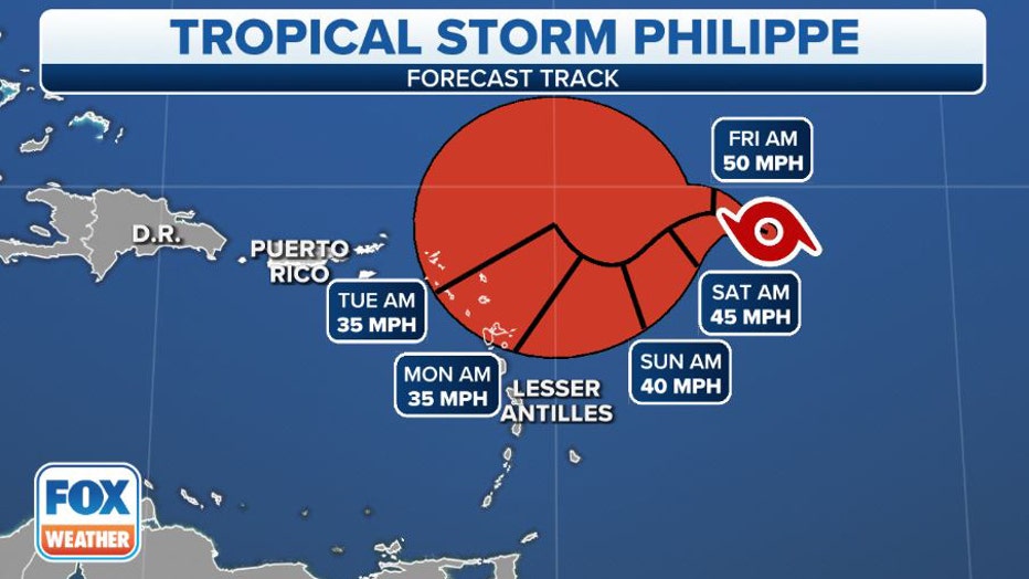
Tropical Storm Philippe's cone. (FOX Weather)
Philippe is the 17th named storm of the 2023 Atlantic hurricane season.
Get the latest updates on this story at FOXWeather.com