Flood Watch
until MON 5:00 AM MST, Eastern Cochise County below 5000 ft including Douglas/Wilcox, Upper Gila River and Aravaipa Valleys including Clifton/Safford, Southeast Pinal County including Kearny/Mammoth/Oracle, Western Pima County including Ajo/Organ Pipe Cactus National Monument, Dragoon/Mule/Huachuca and Santa Rita Mountains including Bisbee/Canelo Hills/Madera Canyon, Tucson Metro Area including Tucson/Green Valley/Marana/Vail, Tohono O'odham Nation including Sells, Baboquivari Mountains including Kitt Peak, Upper San Pedro River Valley including Sierra Vista/Benson, Chiricahua Mountains including Chiricahua National Monument, Galiuro and Pinaleno Mountains including Mount Graham, Santa Catalina and Rincon Mountains including Mount Lemmon/Summerhaven, White Mountains of Graham and Greenlee Counties including Hannagan Meadow, South Central Pinal County including Eloy/Picacho Peak State Park, Upper Santa Cruz River and Altar Valleys including Nogales, Northwest Plateau, Lake Havasu and Fort Mohave, North Phoenix/Glendale, Aguila Valley, Mazatzal Mountains, Tonopah Desert, Gila Bend, San Carlos, East Valley, Northwest Pinal County, Northwest Valley, Southeast Valley/Queen Creek, Globe/Miami, Deer Valley, Fountain Hills/East Mesa, Apache Junction/Gold Canyon, Buckeye/Avondale, Tonto Basin, Rio Verde/Salt River, South Mountain/Ahwatukee, Dripping Springs, Southeast Gila County, Pinal/Superstition Mountains, Scottsdale/Paradise Valley, New River Mesa, Sonoran Desert Natl Monument, West Pinal County, Superior, Cave Creek/New River, Central Phoenix, Yavapai County Mountains, Little Colorado River Valley in Navajo County, Western Mogollon Rim, Coconino Plateau, Chinle Valley, Yavapai County Valleys and Basins, Oak Creek and Sycamore Canyons, Grand Canyon Country, Chuska Mountains and Defiance Plateau, Northeast Plateaus and Mesas South of Hwy 264, Little Colorado River Valley in Coconino County, Black Mesa Area, Marble and Glen Canyons, Northeast Plateaus and Mesas Hwy 264 Northward, Northern Gila County, White Mountains, Kaibab Plateau, Eastern Mogollon Rim, Little Colorado River Valley in Apache County

Stranded dog rescued from bridge 120 feet above Mississippi River

Talk about being in the right place at the right time.

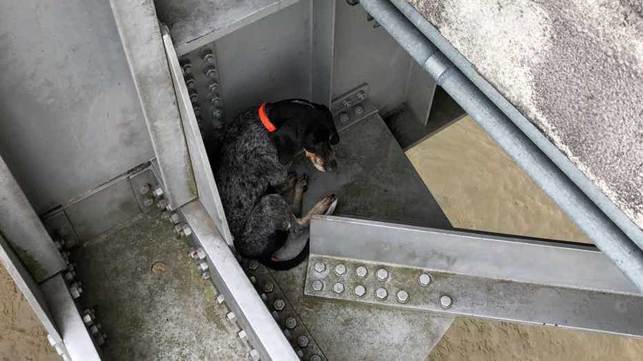
A bridge inspector came to the rescue of a dog stranded 120 feet above the Mississippi River.

Ryan Nataluk was working for bridge-design company Stantec on a span connecting Natchez, Miss. and Vidalia, La. when he noticed a distressed dog beneath the bridge deck.
dog-bridge-rescue-1.jpg

(Stantec via Storyful)

Related: Puppy rescued from charred remains of home in California as wildfires burn

He quickly called the police for assistance and climbed down to the pup to check for any injuries.

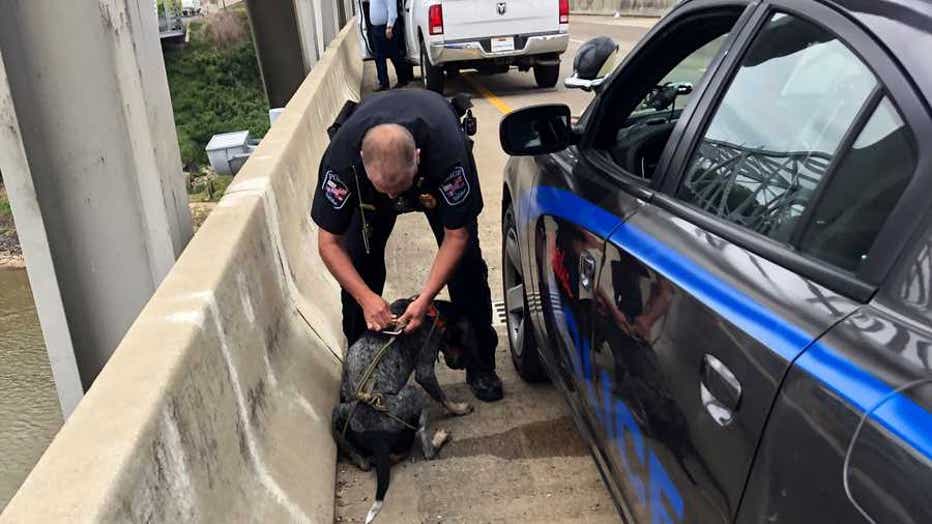
One of his coworkers recorded video as Nataluk, the team's lead climber and rescue technician, created a makeshift harness out of rope. As he balanced himself on the bridge, he then lifted the dog to safety and into the waiting arms of an officer.
dog-bridge-rescue-2.jpg

(Stantec via Storyful)

Stantec posted video of the rescue to Instagram, saying, "No one is sure how she ended up down there, but this heartwarming rescue story proves that not all heroes wear capes."

According to WAPT, Natchez police then took the dog into their care.