

Arizona weather forecast: Wet weather expected in Phoenix and other parts of the state

4 p.m. Weather Forecast - 3/6/25
The rain and snow isn't going away just yet! Storms will pick back up Thursday night into Friday.
PHOENIX - Our winter weather is in full swing.
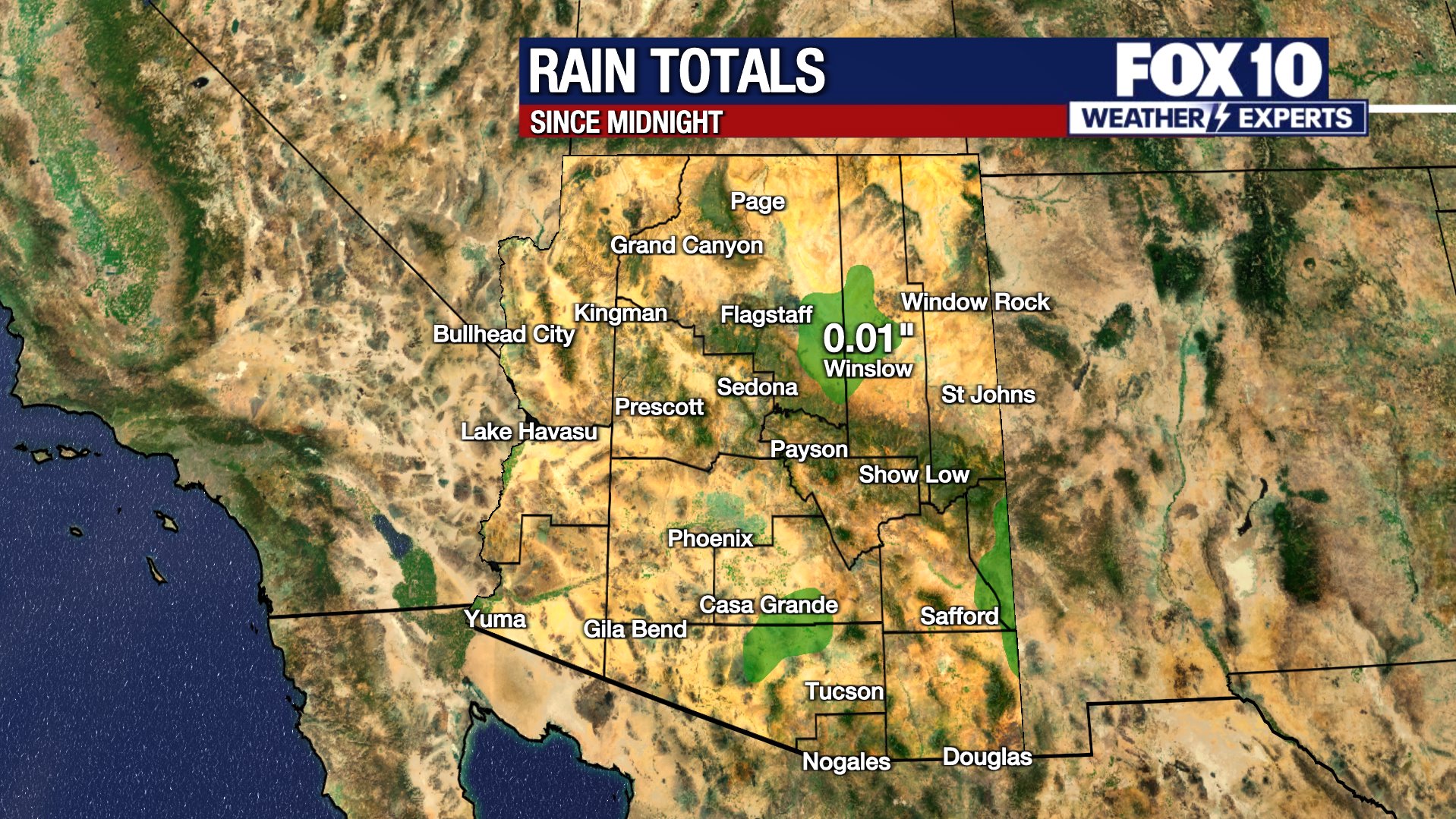
The first round of rain and snow passed the state through the morning, bringing a couple inches of new snow to Flagstaff and a brief period of showers for the west and north Valley around Phoenix.
Today:
Through the afternoon, a few lingering rain/snow showers will pass over northern Arizona. These showers may be briefly heavy, but with marginal temperatures at the higher elevations, new accumulations is mostly unlikely. Instead, the focus shifts to gusty winds the rest of the day. Gusts will pick up 40-50+ mph in Northern Arizona and remain around 20-30+ mph in Phoenix.
A Wind Advisory is in place over Apache, Navajo, and portions of Coconino Counties as well as out toward La Paz County.
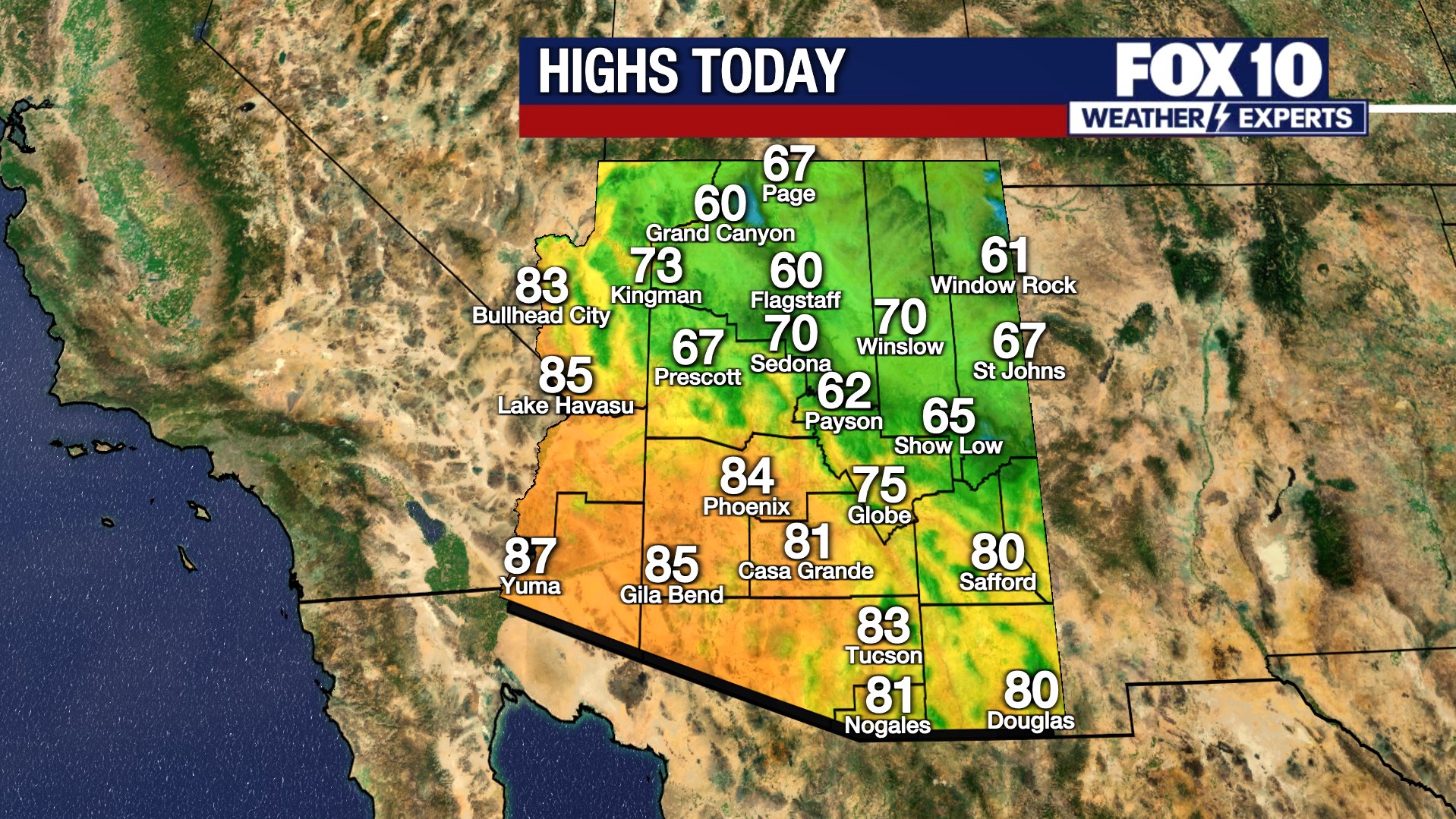
Thanks to the passing cold front, temperatures remain in the upper 60s to near 70 degrees on Thursday in Phoenix. It will be notably cooler overnight as lows fall into the upper 40s with highs only in the upper 50s on Friday.

(Related Video) Storm brings rain, snow to parts of Arizona
It has been an active day of weather across Arizona, with parts of the state seeing rain and even snow. FOX 10's Danielle Miller has more, from Flagstaff, and Krystal Ortiz has more on the weather.
Tomorrow:
The next round of rain and snow will arrive overnight into early Friday morning. In Phoenix, steadier to heavier rain showers are expected during the morning commute. More scattered rain showers will be possible through the afternoon and early evening. Rain totals between 0.25" and 0.50" are expected across the Valley.
Snow showers will develop tonight into Friday across Northern Arizona with snow elevation falling down to near 5000 feet, spots like Prescott and Payson should expect morning snow and slippery commutes. Fairly constant and at times heavy snow is expected the first half of the day over much of north-central Arizona. The morning commute may be dangerous in spots, as snowy and slippery roads are likely. The snow will also expand down the Rim and into the White Mountains through the morning. Bands of heavy snow will continue into the afternoon, although there may be breaks, it will still be impactful throughout the day. This will continue to make for messy conditions on roadways even into the evening commute. The snow will exit the state by Saturday morning.
Snow totals between 1-2 feet or more of snow is possible atop Snowbowl, Sunrise and the top of the Rim. In Flagstaff, totals between 6-10+" is forecast to fall with the second wave, in addition to the 1-3" that fell with the first wave. Totals of 3-6" of snow in Payson, 2-5" in Prescott and 3-6" in Show Low are forecast.
The Weekend:
The weekend warms up quickly. Highs reach the upper 60s in Phoenix on Saturday and upper 70s by Sunday. Both days will be sunny.
You can always check the latest weather conditions by visiting the FOX 10 Phoenix weather page, or download the Free FOX 10 Weather app, which is available on Apple iOS and Android.
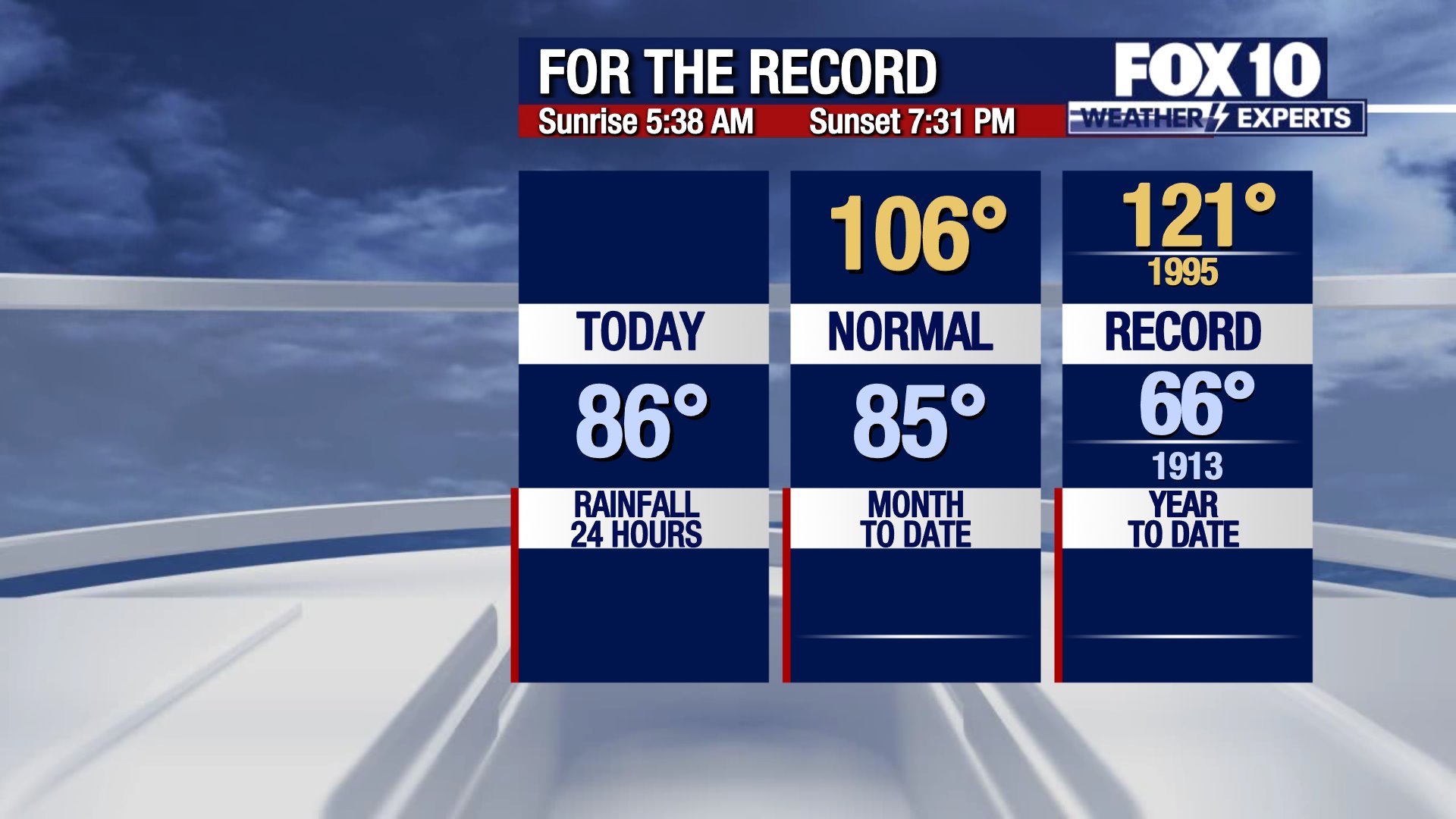
Scroll down this page for satellite and radar, day planner, records, current temperatures, 10-day forecast, forecast highs, and recent rainfall totals, plus live video feeds.


Road Conditions
- Call 511 anywhere in Arizona or 1-888-411-ROAD (7623)
- az511.com