

Arizona weather forecast: Rain showers and cooler temperatures hit the state
Morning rain leaves Phoenix roads soggy
Tuesday morning showers will exit central Arizona this afternoon, bringing cooler air and strong gusts.
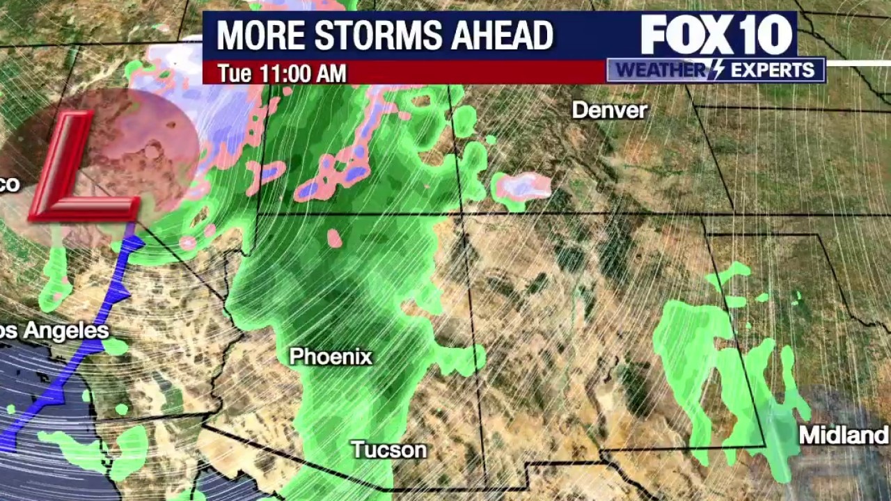
PHOENIX - Much of Phoenix has seen rain at this point, with most residents having had rain pass through. The precipitation is going to continue throughout Tuesday morning. There will be some breaks from time to time, but rain will persist.
Across Arizona:
In Mohave County, the region is experiencing the steadiest and heaviest rain. Yellows, oranges and red spots on radar indicate heavier falling rain from Kingman and Dolan Springs to just outside of Peach Springs, extending all the way to the northwest corner of the state. Because rainfall has been heavier in Mohave County, a flood advisory is in place through 8:30 a.m. due to additional rain potentially creating minor flooding issues, such as in low-lying areas or ponding on the side of roadways. A flood warning would be issued if major issues occurred, though conditions currently warrant a flood advisory.
In Yavapai County, scattered showers are moving through what remains a sensitive area because the ground is still heavily saturated from October rainfall. As a result, it does not take much precipitation to create minor flooding issues. So far, there are no alerts in Yavapai County, though a steadier rain is passing at higher elevations just north of Black Canyon City and running parallel to Interstate 17 near Camp Verde — where devastating flooding occurred a few weeks ago — stretching all the way to Prescott. Lighter showers are currently falling, with steadier rain starting to move into the area.
In Phoenix, conditions are similar, featuring a light to steady rain coming down at a good clip. Drivers will need windshield wipers, though the rain is not creating major issues. Scattered pockets are rolling through much of Phoenix, including the Scottsdale area, where waves of steadier rain are visible through Gainey Ranch and into Taliesin West. In the East Phoenix area, showers are moving through Gilbert to Chandler and along Loop 202 as well.
Futurecast models show moisture pulsing up through the Phoenix-to-Flagstaff line and westward, while everything moves east. At 8 a.m., the model still shows scattered activity around Phoenix and up to Flagstaff. By 11 a.m., the model shows a final line of storms — which could include some thunderstorms — moving through parts of Phoenix to Flagstaff. Past 1 p.m., central and western parts of the state will begin to dry out, while eastern Arizona sees additional activity until about 6 or 7 p.m.
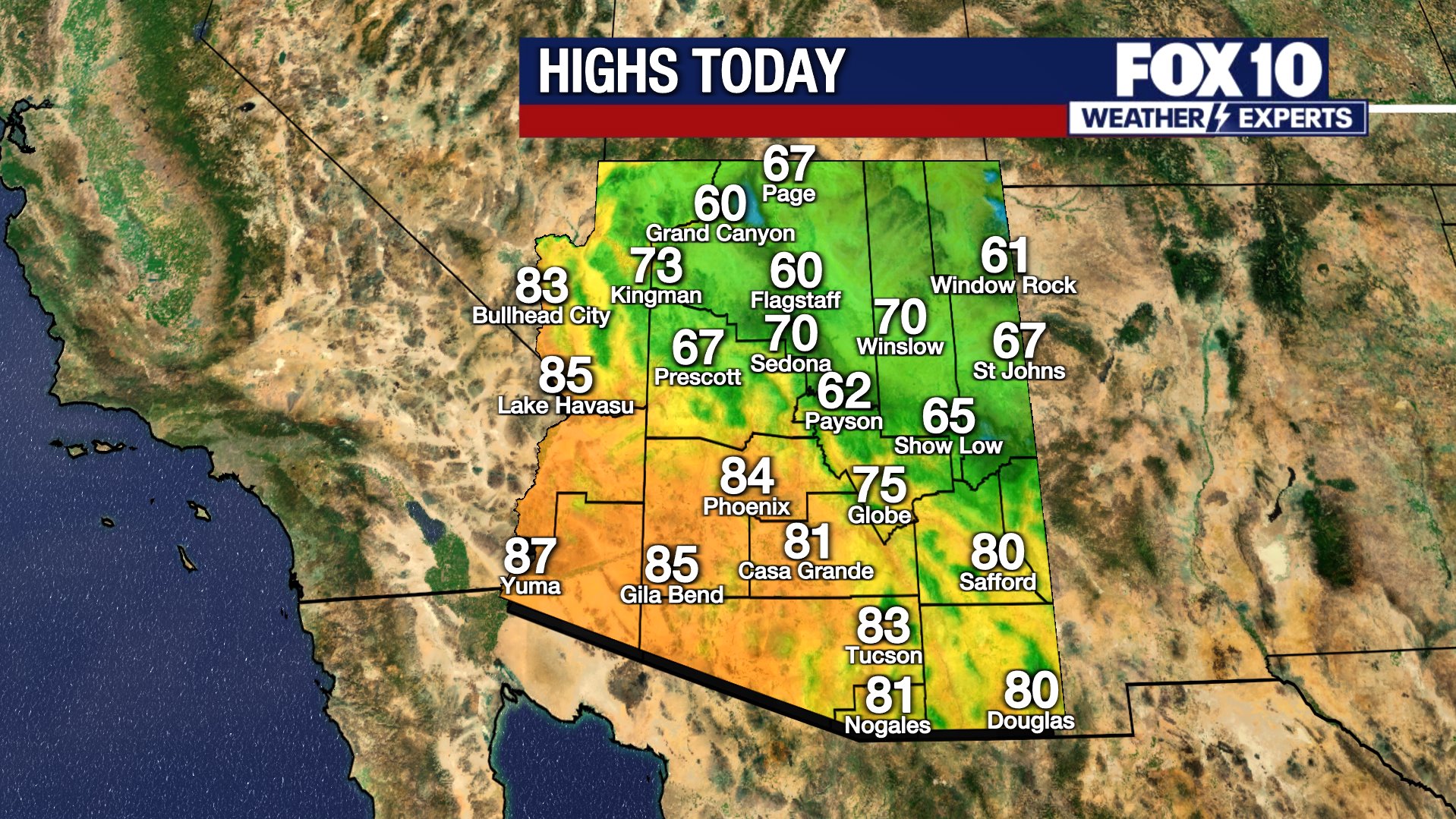
Windy conditions will also develop as winds pick up throughout the morning. Gusts of 35 to 45 mph are expected in Flagstaff, with 40 to 50 mph gusts possible in Show Low and 20 to 30 mph gusts in Phoenix. According to the 10-day forecast, Phoenix will see a high of 71 degrees, and most of the state should expect cooler temperatures than recent days.
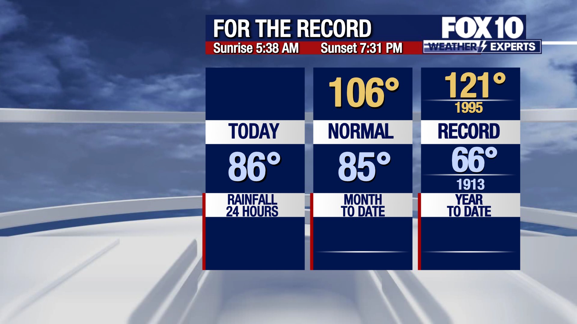
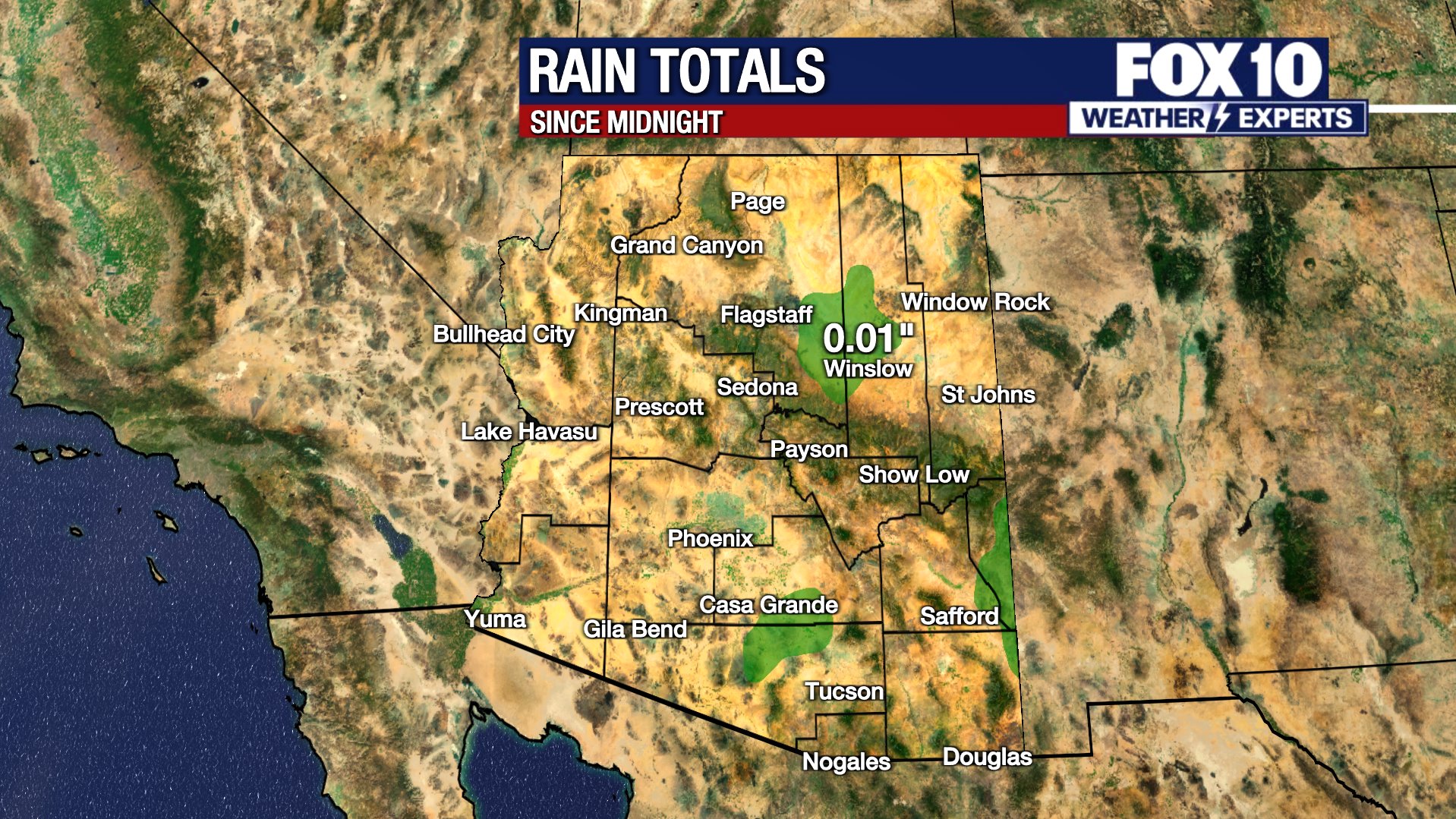
Scroll down this page for satellite and radar, day planner, records, current temperatures, 10-day forecast, forecast highs, and recent rainfall totals, plus live video feeds.





Road Conditions
- Call 511 anywhere in Arizona or 1-888-411-ROAD (7623)
Rain/flood safety tips
The American Red Cross' tips for heavy rain situations and flood safety:
- Turn around don’t drown! If you must drive and you encounter a flooded roadway, turn around and go another way.
- If you are caught on a flooded road and waters are rising rapidly around you, get out of the car quickly and move to higher ground.
- Tune in to your local radio, NOAA radio, or news channels for the latest updates.
- If your neighborhood is prone to flooding, be prepared to evacuate quickly.
- Follow evacuation orders and do not attempt to return until officials say it is safe.
- If power lines are down, do not step in puddles or standing water.
- If power is out, use a flashlight. Do not use any open flame as alternate lighting.
Preparing for a severe thunderstorm
The American Red Cross' tips for preparing for a severe thunderstorm:
- Put together an emergency kit.
- Know your community’s evacuation plan.
- Create a household disaster plan and practice it.
- Purchase a battery-powered or hand-crank radio
- Discuss thunderstorm safety with members of your household. Be aware that a thunderstorm could produce flooding.
- Pick a safe place in your home for household members to gather during a thunderstorm. This should be a place where there are no windows, skylights, or glass doors, which could be broken by strong winds or hail and cause damage or injury.
Watch live: FOX Weather
The Source: Information for this article was gathered by the FOX 10 Weather Experts.