

Baltimore bridge collapse revealed in up-close Coast Guard photos

Bridge collapse: Crane arrives for debris removal
The largest crane on the eastern seaboard has arrived for debris clean-up at the scene of the Key Bridge collapse in Baltimore. FOX's Griff Jenkins joined LiveNOW from FOX's Josh Breslow with a live look at the situation on the ground.
BALTIMORE - As engineers begin to figure out how to clean up the deadly Baltimore bridge collapse, they are getting a closer look at the scene from above and below the water.
The U.S. Coast Guard and Army Corps of Engineers are among the responders at the scene of the Francis Scott Key Bridge collapse, which happened early Tuesday when a cargo barge lost power and rammed a support pillar. Six people, all construction workers on the bridge, were killed.
Thursday, the federal government approved a $60-million "down payment" on efforts to clear the wreckage so the Port of Baltimore can eventually reopen. But that will not be a quick or easy task, as shown by photos released from the scene.
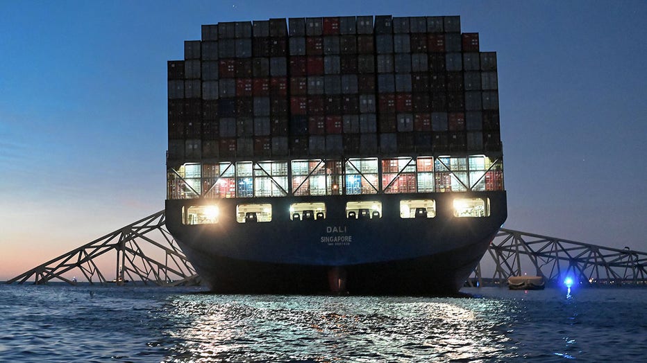
Images show the span’s steel structure twisted and piled atop the stricken ship, which has a huge hole gashed in its bow. Shipping containers and other sections of the bridge are in the Patapsco River and tangled with what remains of the concrete support pillars.
RELATED: NTSB investigating hazmat spill in Baltimore Key Bridge collapse; Probe could last 2 years
Coast Guard Stations Curtis Bay and Annapolis deployed their response boat crews along with a Coast Guard MH-65 Dolphin aircrew to the scene to assist. (U.S. Coast Guard photo by Petty Officer 3rd Class Carmen Caver)
Engineers are still assessing the scene, using aquatic drones and bottom-scanning sonar. It’s not yet clear how long it will take to clear the steel, concrete, and other debris, but experts have already speculated it could take as long as a decade to rebuild the span itself.

Baltimore bridge collapse cleanup could take weeks
LiveNOW's Andrew Craft spoke about the cleanup and the federal funding approved for the project with Washington Post reporter Tom Jackman.