

Baltimore channel affected by bridge collapse set to reopen early June

Baltimore Key Bridge collapse: federal channel set to fully reopen June 8-10
The work to restore Baltimore's federal channel is now projected to wrap up between June 8-10.
BALTIMORE, Md. - The Port of Baltimore's limited access channel has been expanded to a width of 400 feet and a depth of 50 feet, allowing for the transit of all deep-draft commercial vessels, following the removal of the Dali cargo ship on Monday.
The Dali was refloated one week after precision cutting removed the steel truss pinning it down. Once the vessel departed, salvage crews resumed removing wreckage from the Federal Channel.
"We are proud of the unified efforts that have partially reopened the Federal Channel to port operations," said Lt. Gen. Scott Spellmon, commanding general of the U.S. Army Corps of Engineers.
Featured
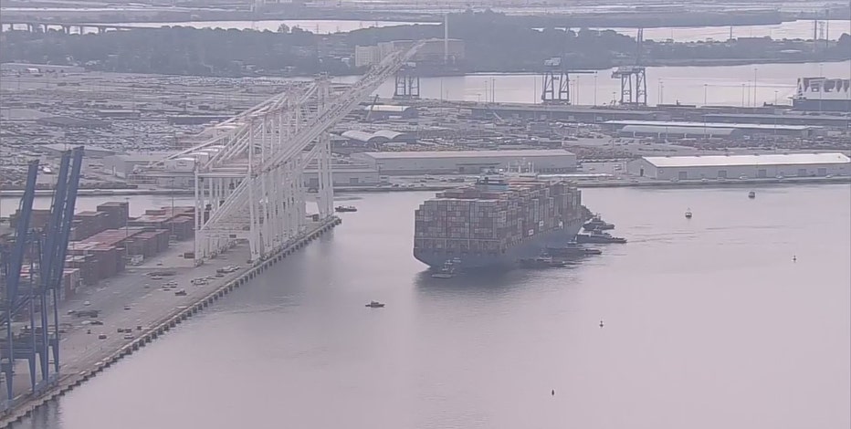
Baltimore Key Bridge collapse: Dali refloated, moved to nearby marine terminal
For the first time in almost two months, the container ship that caused the deadly collapse of Baltimore's Francis Scott Key Bridge, is moving.
The U.S. Army Corps of Engineers continues to work on restoring the Federal Channel to its original 700-foot width and 50-foot depth by clearing the remaining wreckage from the riverbed. This involves digging out the bottom cord of the remaining truss and cutting it into three sections for safe removal.
"We are not taking our foot off the gas," said Col. Estee S. Pinchasin, USACE, Baltimore District commander. "We are pushing forward as quickly and safely as possible to reach 700 feet and ensuring we remove all wreckage to prevent any impact to future navigation."
Only about one-third of the truss is visible above the water, with the rest buried in the riverbed. Based on recent dive surveys and engineer analysis, the work to restore the Federal Channel is projected to conclude between June 8-10.
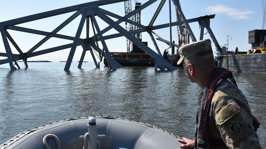
This timeline accounts for the complexity of the cutting and rigging required and possible weather disruptions.
"This effort is more complex than initially estimated," Pinchasin said. "Salvage crews must dig out the bottom cord of this truss to access the areas needing to be cut."

Dali cargo ship refloated, moved to nearby marine terminal
For the first time in nearly two months, the massive Dali ship that crashed into the Key Bridge in Baltimore has been freed. Crews have successfully docked the ship at a terminal as they work to get channels back to pre-collapse conditions. FOX 5's Lili Zheng has the story.
The goal remains to restore full operational capacity to the Federal Channel. While the channel's width has reached 400 feet, allowing all vessels to navigate the Port of Baltimore, more work is needed to achieve the full 700-foot width of the Fort McHenry Channel.
The U.S. Army Corps of Engineers continues to coordinate with all agencies involved in the Unified Command to complete the restoration.