

Arizona weather forecast: A chance for rain this week in Phoenix
4 p.m. Weather Forecast - 3/5/2025
A few cloudy days and some rain drops are on the way for the Phoenix-metro area.
PHOENIX - An eventful couple days ahead!
Today:
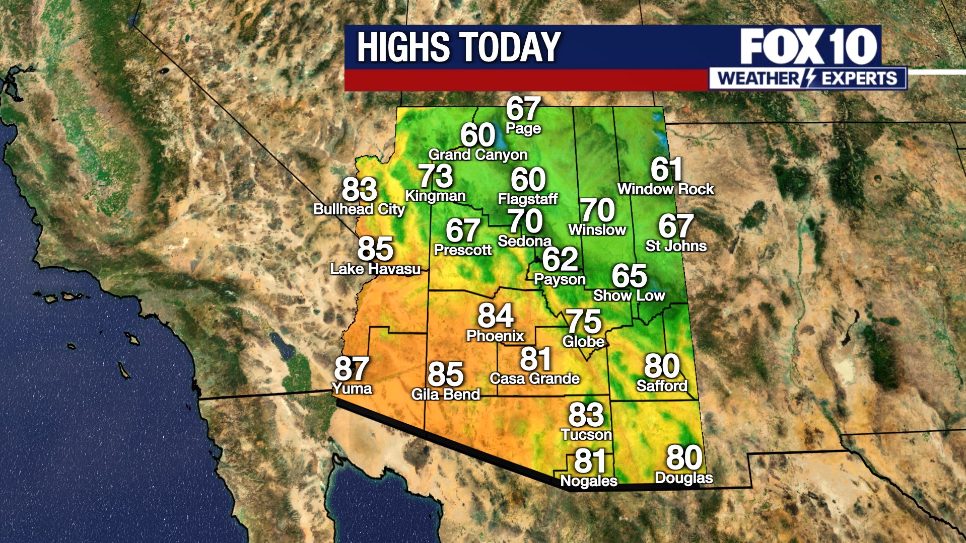
Ahead of rain, snow, gusty winds and cooler temperatures, Wednesday acts as the "calm before the storm". High temperatures reach the middle to upper 70s in the Valley with light winds and increasing cloud cover.
Tomorrow:
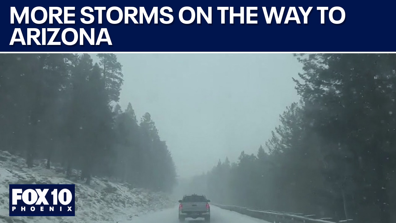
Beginning Thursday morning, the first of two rounds of wet weather will pass across the state. The first round brings snow to the high elevations of Yavapai and Coconino Counties, especially in the morning. Areas like Flagstaff may see several inches of snowfall during the morning commute, making for messy roads.
A Winter Weather Advisory is in place for the Kaibab Plateau and for the area surrounding Flagstaff due to dicey travel and periods of low visibility with possible blowing snow. Gusts will pick up 40-50+ mph in Northern Arizona throughout the day Thursday. A Wind Advisory is in place over Apache, Navajo, and portions of Coconino Counties.
During the afternoon Thursday, a few scattered rain/snow showers will continue in Northern Arizona. The first round of wet weather takes a pause by Thursday evening and night.
In the Valley, the first round brings hit-or-miss rain showers. They will pass between 7 am and 10 am, west to east. By the afternoon, Phoenix should return to sunshine with highs only hitting the mid-upper 60s.
The Weekend:
The next round of rain and snow will arrive early Friday morning. In Phoenix, steadier to heavier rain showers are expected during the morning commute. More scattered rain showers will be possible through the afternoon and early evening.
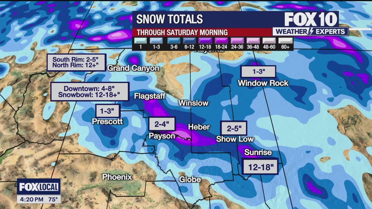
Snow showers will develop early over Northern Arizona with snow elevation falling down to near 5000 feet. Spots like Prescott and Payson should expect morning snow and slippery commutes. The snow will remain steady in those areas into the afternoon as it continues to spread along the Mogollon Rim and White Mountains. The snow will exit the state by Saturday morning.
While forecast snow totals may need to be adjusted, over a foot of snow is possible atop Snowbowl, Sunrise and the Kaibab Plateau. In Flagstaff, 4-8" is forecast to fall between Thursday and Saturday (although some melting is likely to occur as it falls/between rounds). Totals of 2-4" in Payson and 1-3" in Prescott are expected, too.
The weekend warms up quickly. Highs reach the upper 60s in Phoenix on Saturday and upper 70s by Sunday. Both days will be sunny.
(Related Video) How experts measure and report snowfall totals
As Arizona gets ready for storms in the coming days, people can help measure and report snowfall levels. FOX 10 Meteorologist Krystal Ortiz has some weather wisdom for us.
You can always check the latest weather conditions by visiting the FOX 10 Phoenix weather page, or download the Free FOX 10 Weather app, which is available on Apple iOS and Android.
Scroll down this page for satellite and radar, day planner, records, current temperatures, 10-day forecast, forecast highs, and recent rainfall totals, plus live video feeds.


Road Conditions
- Call 511 anywhere in Arizona or 1-888-411-ROAD (7623)
- az511.com