

Dangerous, record-setting heat to continue from the Midwest to Southeast
Millions of Americans from the Midwest to the Southeast hoping for some relief from record-setting high temperatures this week will need to wait a few more days before that occurs.
The National Weather Service says a dome of high-pressure building in the southeastern U.S. is expected to produce well-above-average to record-breaking temperatures across the region through at least Wednesday.
That will put nearly 115 million people at risk of heat-related illnesses on Tuesday.
As the life-threatening heat continues to build, the NWS has issued Excessive Heat Watches, Excessive Heat Warnings and Heat Advisories for nearly one-third of the U.S. population.
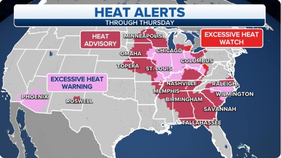
Heat alerts are in effect across the Midwest and into the mid-Atlantic and Southeast.(FOX Weather)
Heat Advisories stretch from Minnesota and the upper Midwest all the way to the Gulf Coast, Southeast and parts of the mid-Atlantic.
A large part of the Ohio Valley and areas of the upper and mid-Mississippi Valley are included in an Excessive Heat Warning. That includes the cities of St. Louis, Chicago and Columbus, Ohio. In addition, Excessive Heat Warnings are in effect in the Carolinas from Raleigh, North Carolina, into parts of northeastern South Carolina.
Excessive Heat Watches are also in effect for parts of southeastern Michigan and West Virginia.
HOW THE WEATHER YOU'RE ACCUSTOMED TO AFFECTS NATIONAL WEATHER SERVICE HEAT WARNINGS, ADVISORIES
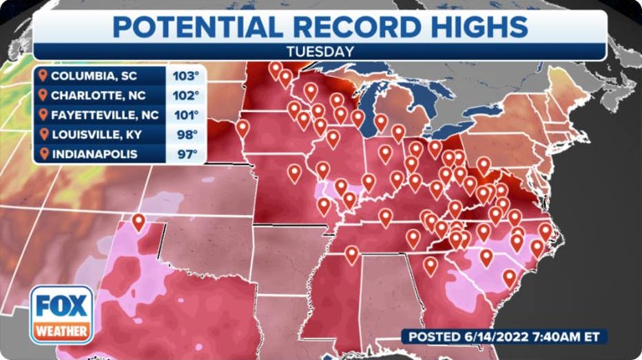
Records in jeopardy of being broken on Tuesday, June 14.(FOX Weather)
Here's a look at the dozens of record-high temperatures that are in jeopardy of being broken on Tuesday.
Every marker you see on the map above indicates a location where a record could be tied or broken.
Those records in jeopardy extend from central Minnesota and the Midwest south and eastward through the Ohio and Tennessee valleys and into the mid-Atlantic and Southeast.
HOW TO TELL THE DIFFERENCE BETWEEN HEAT EXHAUSTION AND HEATSTROKE
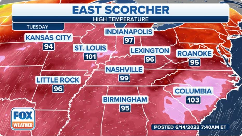
High temperatures on Tuesday, June 14.(FOX Weather)
Let's take a closer look at some high temperatures expected on Tuesday.
Most areas will generally be in the 90s. However, some locations could be very close to or above 100 degrees.
St. Louis, for example, will see a high temperature of about 101 degrees, with Nashville, Tennessee, to the southeast seeing a high temperature of around 99 degrees.
Into the Carolinas, temperatures will be above 100 degrees, including Columbia, South Carolina, which could hit 103 degrees.
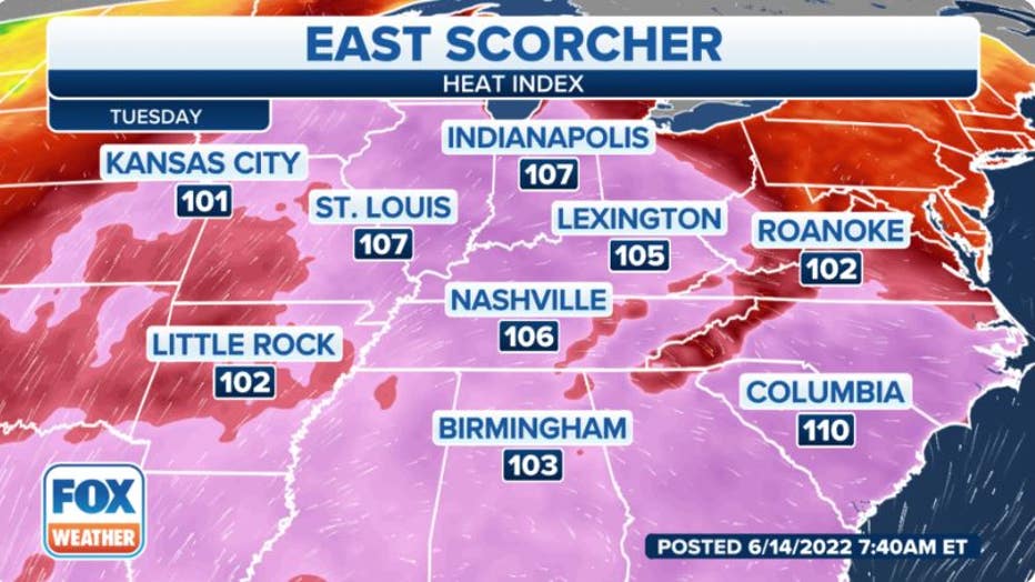
The heat and humidity will make it feel higher than 100 degrees on Tuesday.(FOX Weather)
And when you factor in the humidity, numerous areas could feel well above 100 degrees.
St. Louis and Indianapolis will feel like it's 107 degrees, with Nashville and Lexington, Kentucky, feeling the same.
Closer to the East Coast, Columbia will feel like it's 110 degrees on Tuesday afternoon.
Heat precautions
During this dangerous heat wave, it'll be imperative to take the proper precautions to stay cool and stay safe.
First off, try to limit the time spent outdoors during excessive heat. The best time to be outdoors would be early in the morning or later in the evening.
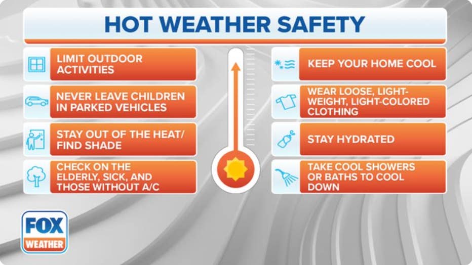
Here are some hot weather safety tips. (FOX Weather)
If you need to go outdoors during the day, wear loose, lightweight and light-colored clothing and drink plenty of fluids.
CLICK HERE TO GET THE FOX WEATHER UPDATE PODCAST
Always "look before you lock" to ensure you have not left any children or pets inside a car. Temperatures inside a locked vehicle with the windows rolled up can be deadly.
Track the temperatures in your area with the FOX Weather app. The free FOX Weather livestream is also available 24/7 on the website and app and on your favorite streaming platform. The FOX Weather Update podcast also provides weather information for the entire country.