Flood Watch
until MON 5:00 AM MST, Eastern Cochise County below 5000 ft including Douglas/Wilcox, Upper Gila River and Aravaipa Valleys including Clifton/Safford, Southeast Pinal County including Kearny/Mammoth/Oracle, Western Pima County including Ajo/Organ Pipe Cactus National Monument, Dragoon/Mule/Huachuca and Santa Rita Mountains including Bisbee/Canelo Hills/Madera Canyon, Tucson Metro Area including Tucson/Green Valley/Marana/Vail, Tohono O'odham Nation including Sells, Baboquivari Mountains including Kitt Peak, Upper San Pedro River Valley including Sierra Vista/Benson, Chiricahua Mountains including Chiricahua National Monument, Galiuro and Pinaleno Mountains including Mount Graham, Santa Catalina and Rincon Mountains including Mount Lemmon/Summerhaven, White Mountains of Graham and Greenlee Counties including Hannagan Meadow, South Central Pinal County including Eloy/Picacho Peak State Park, Upper Santa Cruz River and Altar Valleys including Nogales, Northwest Plateau, Lake Havasu and Fort Mohave, North Phoenix/Glendale, Aguila Valley, Mazatzal Mountains, Tonopah Desert, Gila Bend, San Carlos, East Valley, Northwest Pinal County, Northwest Valley, Southeast Valley/Queen Creek, Globe/Miami, Deer Valley, Fountain Hills/East Mesa, Apache Junction/Gold Canyon, Buckeye/Avondale, Tonto Basin, Rio Verde/Salt River, South Mountain/Ahwatukee, Dripping Springs, Southeast Gila County, Pinal/Superstition Mountains, Scottsdale/Paradise Valley, New River Mesa, Sonoran Desert Natl Monument, West Pinal County, Superior, Cave Creek/New River, Central Phoenix, Yavapai County Mountains, Little Colorado River Valley in Navajo County, Western Mogollon Rim, Coconino Plateau, Chinle Valley, Yavapai County Valleys and Basins, Oak Creek and Sycamore Canyons, Grand Canyon Country, Chuska Mountains and Defiance Plateau, Northeast Plateaus and Mesas South of Hwy 264, Little Colorado River Valley in Coconino County, Black Mesa Area, Marble and Glen Canyons, Northeast Plateaus and Mesas Hwy 264 Northward, Northern Gila County, White Mountains, Kaibab Plateau, Eastern Mogollon Rim, Little Colorado River Valley in Apache County

Full 'flower moon' to shine Friday night: What to know

Published May 1, 2026 7:13 AM MST

Stargazers will be treated to the first of two May full moons Friday night with the rise of the full "flower moon."

Here’s what to know about the micromoon: 

May’s full flower moon

Big picture view:

The full flower moon is a micromoon named for the blooms on Earth that are typically illuminated by the moon in late spring. 

RELATED: NASA unveils panoramic Nancy Grace Roman Space Telescope

According to the Farmers Almanac, the flower moon will reach peak brightness at 1:23 p.m. ET, which means most Americans won’t be able to see it at its brightest. But it will still shine bright over clear skies, making Friday night a good night for stargazing. 
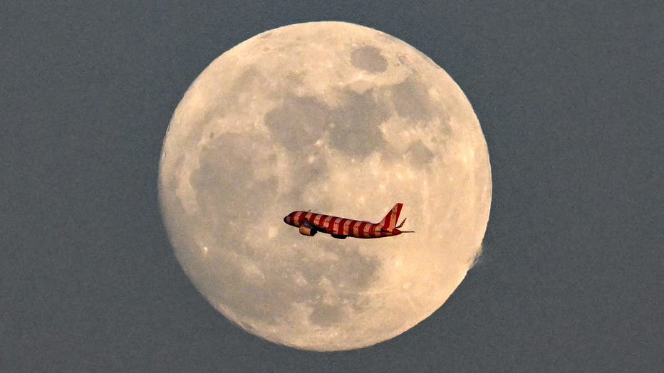
An Airbus A320-271N aircraft of German airline Condor flies past the Waxing Gibbous Moon over Frankfurt am Main, western Germany on April 30, 2026 on the eve of May full moon, also known as "Flower Moon". (Photo by Kirill KUDRYAVTSEV / AFP via Getty

What is a micromoon? 

Dig deeper:

A micromoon happens when the moon is at its farthest point from Earth in its orbit, known as apogee. 

According to NASA, May’s full flower moon will be roughly 249,180 miles from Earth.

RELATED: NASA 'looking into' reclassifying Pluto as a planet after 10-year-old's viral letter

A "supermoon," on the other hand, happens when a full moon coincides with the moon's closest approach to Earth in its elliptical orbit, according to FOX Weather. 

When’s the next full moon? 

Timeline:

The next full moon – the "blue moon" – will rise on May 31.

RELATED: Virgin Galactic raises spaceflight ticket prices to $750K

The blue moon gets its name from the phrase, "Once in a blue moon," as blue moons happen when there are two full moons in one month. 

The Source: This report includes information from NASA and FOX Weather.

Air and SpaceU.S.News