

Arizona weather forecast: Storms hit Phoenix ahead of Halloween weekend washout
Arizona storm forecast: Phoenix rain and flood risk
Thunderstorms move across Phoenix and northern Arizona on Friday ahead of another heavy rainmaker this weekend.
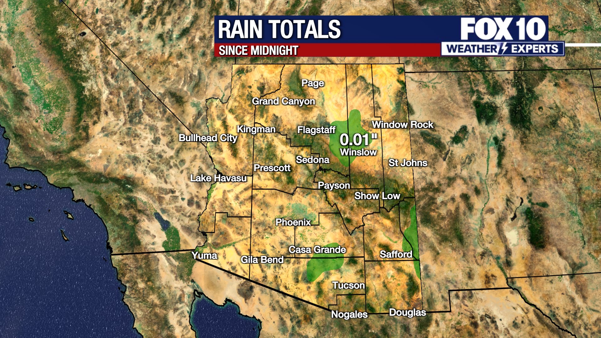
PHOENIX - As the morning progresses and right through the afternoon, chances for rain and thunderstorms are active around the state. Radar displays on FOX Vision indicate conditions are developing into a substantial soaking rain.
The Valley:
As these storms progress, a closer look at Phoenix reveals a small wave moving from Pinal County into parts of south Phoenix out to Ahwatukee. The main body of thunderstorms is pushing into the west edge of the Phoenix area. Buckeye has experienced storms for an extended period, with waves of thunderstorms and lightning moving northward.
The system is beginning to reach Loop 303, bringing pockets of heavier rain into the Avondale and Perryville areas. That activity extends along Loop 303 all the way to the U.S. 60, where it reaches Wickenburg. The passing thunderstorms will eventually cross State Route 74 near Lake Pleasant. As the system shifts eastward, Black Canyon City and additional parts of Glendale will see storm activity develop.
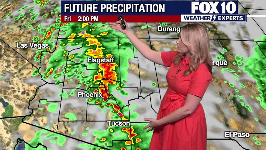
Lighter showers are crossing over South Mountain, where camera views show active rainfall from a passing cell. Downtown Phoenix is also experiencing a few light showers. Steadier rain is falling along Interstate 10 just south of Sun Lakes and tracking toward Ahwatukee.
Northern Arizona:
In the High Country, precipitation has begun breaking up. Scattered showers remain along the Mogollon Rim and extend up toward Flagstaff, though conditions are no longer as active as they were one or two hours ago.
Forecast models track a cluster of storms to the northeast along with a second cluster moving in from the west. That storm complex is expected to strengthen through the morning. By 11 a.m., substantial rain and thunderstorms are projected across Phoenix while extending northward to fill in toward Flagstaff. The weather system will continue crossing Phoenix into the early to mid-afternoon hours before moving out of the metro area tonight.
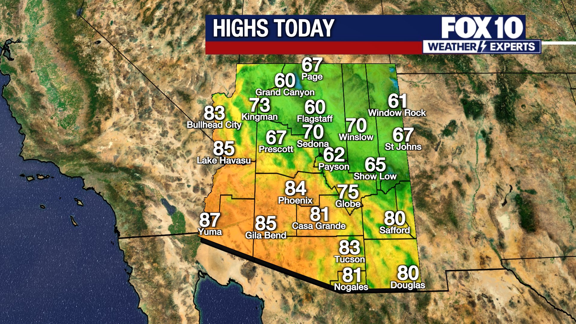
Temperatures will reach highs of 75 degrees in Phoenix, 52 degrees in Flagstaff, and 64 degrees in Winslow.
What to Expect on Halloween:
Drying conditions will arrive across Phoenix tonight, while eastern Arizona will continue seeing wet weather overnight before clearing by Saturday morning for Halloween.
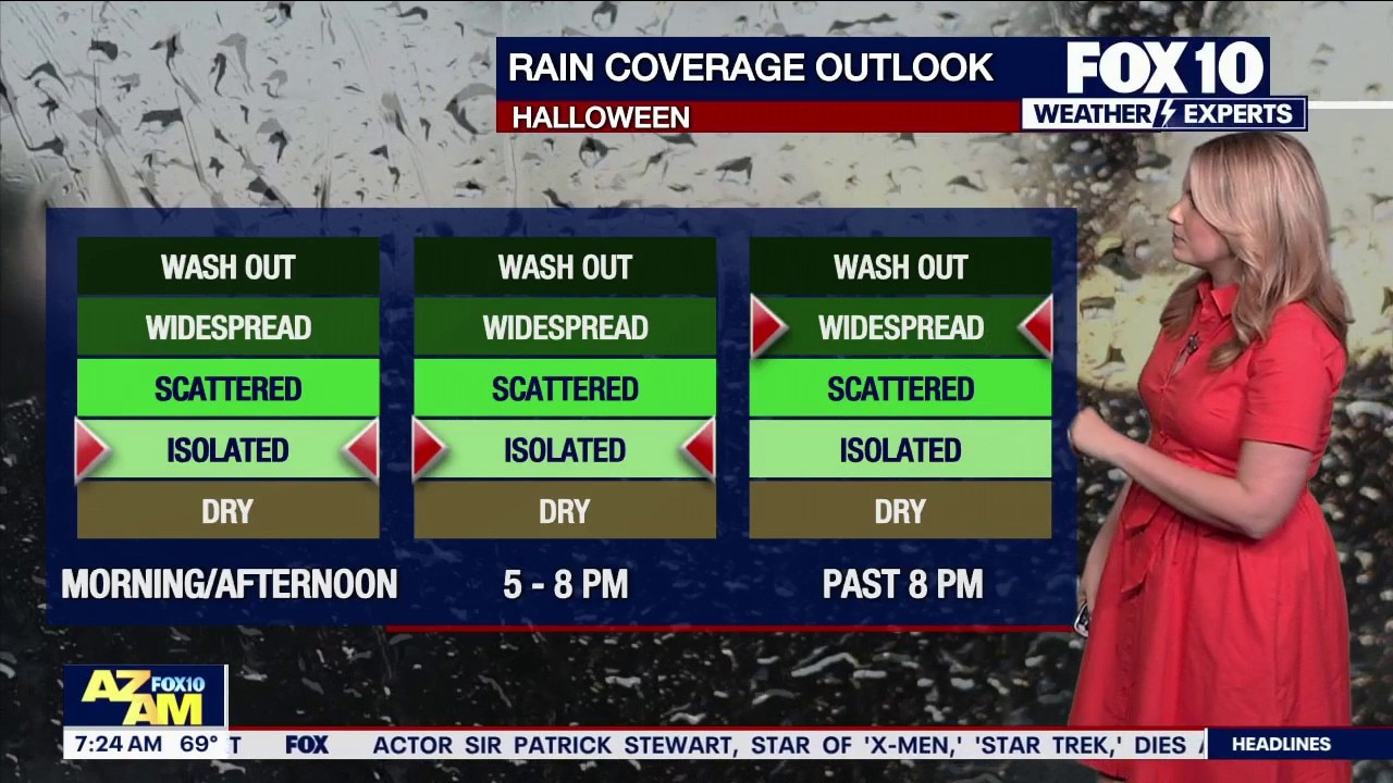
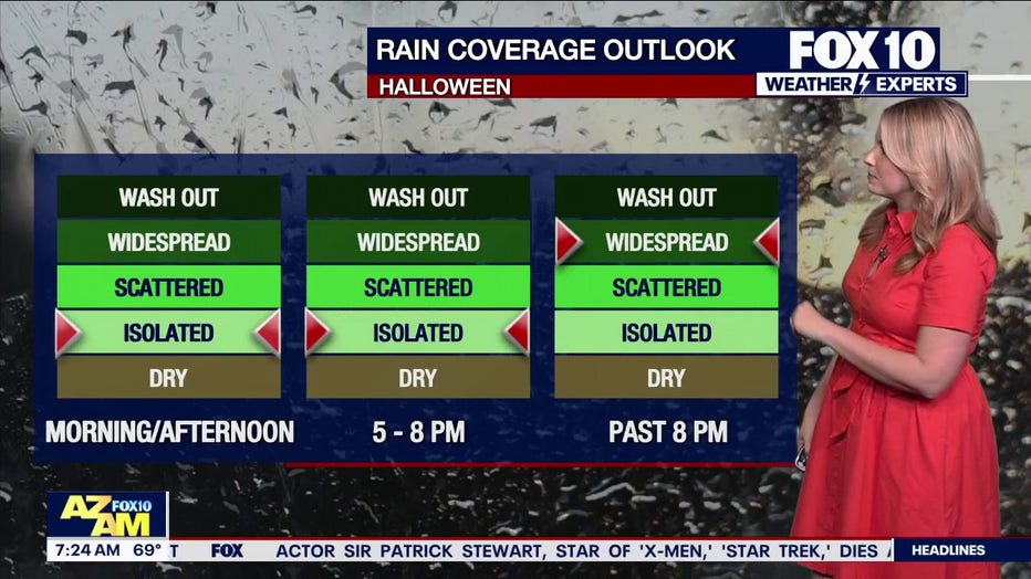
The Halloween outlook features isolated, light showers during the morning and afternoon. Mostly spotty activity will continue through the early trick-or-treating hours between 5 p.m. and 8 p.m., while conditions remain fairly dry under cloudy skies. However, moisture will creep in from the southwest corner of the state. After 8 p.m., rainfall will quickly sweep through Phoenix and advance to northeastern Arizona, becoming increasingly widespread.
Sunday is expected to be a washout. A larger trough and an atmospheric disturbance tracking along the jet stream will push southerly moisture into the region. Rain will turn heavy by Sunday morning and persist as heavy rainfall right through Sunday afternoon.
Because of the combined rainfall from today and Sunday, river flooding forecasts from the National Weather Service are raising concerns. Wet Beaver Creek in Rimrock and a wash near Tuba City are both forecast to reach moderate flood levels over the next several days.
Big picture view:
The 10-day forecast keeps temperatures in the mid-70s today, followed by an afternoon high of 78 degrees for Halloween on Saturday. Temperatures may turn chilly during Saturday night trick-or-treating, dipping into the upper 60s depending on the hour. Sunday will drop to a high of 72 degrees before skies dry out, with high temperatures remaining in the 70s through next week.
You can always check the latest weather conditions by visiting the FOX 10 Phoenix weather page, or download the Free FOX 10 Weather app, which is available on Apple iOS and Android.
Scroll down this page for satellite and radar, day planner, records, current temperatures, 10-day forecast, forecast highs, and recent rainfall totals, plus live video feeds.





The following heat safety information was provided by the Scottsdale Fire Department.
What are Heat Emergencies?
Heat Cramps: Profuse sweating, fatigue, extreme thirst, muscle cramps
Heat Exhaustion: Headache, dizziness, weakness, nausea/vomit, Cool/moist skin
Heat Stroke: Elevated temp. +103degrees, confusion/irrational behavior, dry/hot skin, rapid shallow breathing, rapid weak pulse (shock), seizures, unconscious
What to do
- Get person into shade or cool location.
- Cool person with cool, wet cloths (neck, groin, armpits, head) and fan body.
- Sip cool water if person is alert.
- For muscle cramps, massage muscles gently, but firmly until relaxed.
- *If symptoms worsen, call 911.
What not to do
- Do not give anything by mouth if person is vomiting, unable to swallow or unconscious.
- Do not underestimate the seriousness of a heat emergency.
- Prevention/Preparation for hike/exercise in heat.
Know your limitations
- Hydrate (begins day prior to hike/exercise, hour before hike, during and after).
- Wear proper clothing, lightweight and light color, protect head, proper shoes.
- Always carry a cell phone and best to hike with company.
- Always tell someone where you are hiking and when to plan to return.
Preventing heat exhaustion/heat stroke
The Arizona Department of Health Services stated the following precautions can be taken to prevent heat exhaustion or heat stroke:
- Stay in air-conditioned buildings.
- Find a cooling center/hydration station.
- Limit outdoor activity during the hottest part of the day (mid-day).
- Check on at-risk friends, family, and neighbors at least twice a day.
- Drink water before, during, and after working or exercising outside.
- Check the UV Index.
- Check the heat risk map.
Road Conditions
- Call 511 anywhere in Arizona or 1-888-411-ROAD (7623)
Rain/flood safety tips
The American Red Cross' tips for heavy rain situations and flood safety:
- Turn around don’t drown! If you must drive and you encounter a flooded roadway, turn around and go another way.
- If you are caught on a flooded road and waters are rising rapidly around you, get out of the car quickly and move to higher ground.
- Tune in to your local radio, NOAA radio, or news channels for the latest updates.
- If your neighborhood is prone to flooding, be prepared to evacuate quickly.
- Follow evacuation orders and do not attempt to return until officials say it is safe.
- If power lines are down, do not step in puddles or standing water.
- If power is out, use a flashlight. Do not use any open flame as alternate lighting.
Preparing for a severe thunderstorm
The American Red Cross' tips for preparing for a severe thunderstorm:
- Put together an emergency kit.
- Know your community’s evacuation plan.
- Create a household disaster plan and practice it.
- Purchase a battery-powered or hand-crank radio
- Discuss thunderstorm safety with members of your household. Be aware that a thunderstorm could produce flooding.
- Pick a safe place in your home for household members to gather during a thunderstorm. This should be a place where there are no windows, skylights, or glass doors, which could be broken by strong winds or hail and cause damage or injury.
Watch live: FOX Weather
The Source: Information for this article was gathered by the FOX 10 Weather Experts.