

Philly plane crash: Images and video from the scene

Philly plane crash: Gov Shapiro, Mayor Parker provide update
After a plane crashed into a Philadelphia neighborhood, Pennsylvania Governor Josh Shapiro and Philadelphia Mayor Cherelle Parker update the situation on the ground.
Hundreds of firefighters and first responders have descended on Northeast Philadelphia after a plane carrying six people, including a pediatric patient, crashed Friday evening.
The incident occurred around 6:30 p.m. near Cottman Avenue and Bustleton Avenue near Rossevelt mall.
Here are some images and video from the scene:

Philly plane crash: Nearby diner patron hit by plane crash debris
A plane crashed into a Philadelphia neighborhood sending debris into a diner, seriously injuring a patron who was hit in the head.

Video shows fireball after plane crash
Footage taken near the Roosevelt Mall shows a large fireball seconds after a plane crash, followed by multiple fires. Credit: @st4ced_up via Storyful.

Listen: Doorbell cam captures sound of plane crash
Moments before the Philadelphia plane crash, a doorbell camera captured the sound of the Learjet's screaming engines, followed by the blinding fireball. Video provided by Kiara Rios.

Philly plane crash: Doorbell camera captures crash in Northeast Philadelphia
Doorbell camera captured the moment a plane crashed in a Philadelphia neighborhood late Friday night. The FAA says at least two people were on board.
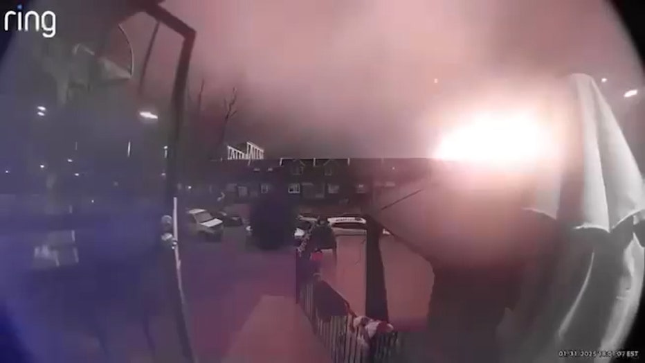
Still image taken from Ring video showing a fireball erupting after a small plane crashed in Northeast Philadelphia on Jan. 31, 2025. (Credit: LiveNOW from FOX viewer)

Philadelphia plane crash scene: Raw video
Moments after a plane crashed near Roosevelt Mall in northeast Philadelphia, FOX 29's Steve Keeley arrived on scene and took this video of the chaos and burning debris. Warning: This is raw video.
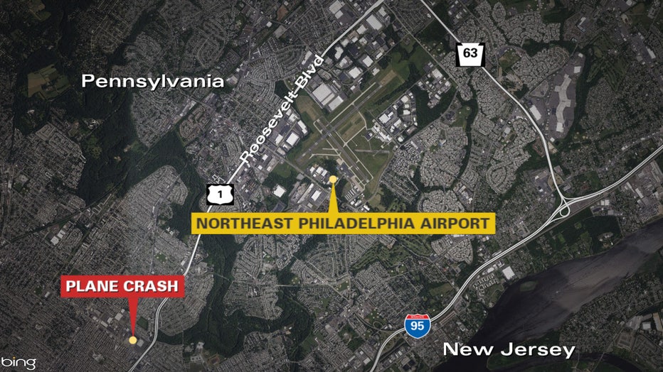

Video shows apparent plane crash in Northeast Philadelphia
A FOX 29 viewer's doorbell camera captured video of what appears to be a plane crash in Northeast Philadelphia.
The Source: Information for this article was gathered from FOX 29 Philadelphia reporting from the scene on Jan. 31, 2025 and various user-submitted videos. This story was reported from Los Angeles.