

Walnut Fire in Cochise County now 100% contained
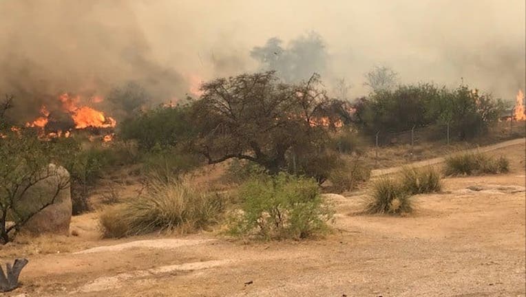
Walnut Fire (Cochise County Sheriff's Office)
WILLCOX, Ariz. - A wildfire that burned near Benson and Willcox is now 100% contained.
The Walnut Fire, which started on June 20 due to lightning, ballooned in size after extreme heat, gusty winds and dry vegetation added more fuel to the flames.
10,667 acres of grass and brush have burned as a result of the fire.
All evacuations have been lifted.
Timeline of the Walnut Fire
June 29
The Walnut Fire is now 100% contained. The fire burned 10,667 acres and was caused by lightning.
June 27
The Walnut Fire has grown to 10,262 acres and is 56% contained.
June 26
10,081 acres have burned and the fire is 33% contained.
176 people are assigned to fight the wildfire.
"The north end of the fire continues to burn unconsumed fuels, producing smoke likely visible from I-10, Willcox, and Benson," stated the ABQ Zone Incident Management Team.
State Trust Lane in all 15 counties remains closed for recreational use.
June 25
The Walnut Fire is 9,717 acres and 19% contained.
"While I-10 remains open, drivers need to use caution as firefighters continue to work in the area. Afternoon smoke may drift onto the highway as winds increase. There are no areas in SET or GO, but residents should always be prepared; create defensible space and sign up for emergency alerts through your county's emergency management office website," stated Arizona Dept. of Forestry and Fire Management officials.
June 24
The Walnut Fire has grown to 8,572 acres and is uncontained.
"The much-welcomed, scattered precipitation fell over the fire area yesterday afternoon, keeping fire spread minimal," officials said. "This allowed firefighters to make progress on containment lines, begin mop-up, and formulate a strategic direct plan of attack on the Walnut Fire.
All "GO" orders for the Dragoon area were lifted as of Wednesday afternoon and there are no road closures.
About 80 personnel have been assigned to fight the flames.
June 23
The Walnut Fire has grown to 7,846 acres and remains 0% contained.
The eastbound lanes of Interstate 10 between mileposts 319 and 323 have reopened. The right westbound lane is closed at milepost 331.
June 22
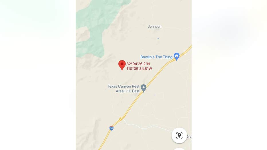
A map showing the location of the Walnut Fire
More wildfire coverage
- What to know about the Rafael Fire: Evacuations ordered, road closures underway
- What to know about the Wyrick Fire near Heber: Evacuations ordered, highways closed
- Map: Every wildfire burning in Arizona
For the latest local news, download the FOX 10 News app.
Tune in to FOX 10 Phoenix for the latest news: