

Arizona weather forecast: First of 3 storms bringing rain, snow to the state
Evening Weather Forecast - 2/17/26
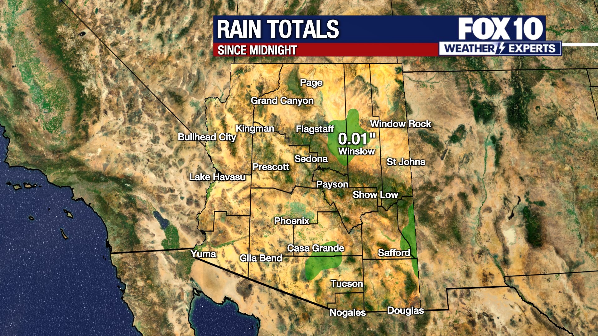
It was a wet Tuesday in Arizona, and things aren't drying out anytime soon. FOX 10's Erica Horvatin has the details.
PHOENIX - Tuesday was a breezy, partly sunny day in the Valley.
Rain showers moved through during the early morning, bringing .08" of rain at Phoenix Sky Harbor, and generally around .10" to .20" across the Valley.
The high country saw light snowfall above 6,000 ft and rain showers below. Flagstaff picked up 1.3" of snow at the airport.
The weather is winding down this evening in the mountains, and the night will be dry and cold. Temperatures will fall to around 50 degrees in Phoenix.
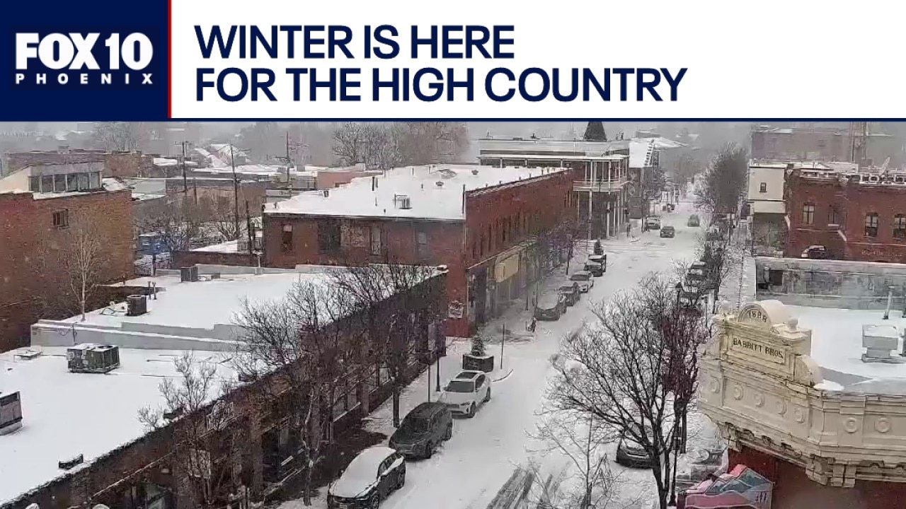
Big winter storm batters parts of Arizona
It has been a day of active weather for parts of Arizona, as a big winter storm brought a lot of snow to the high country, and rain to parts of the Valley. FOX 10's Ashley Loaeza has more, from Flagstaff.
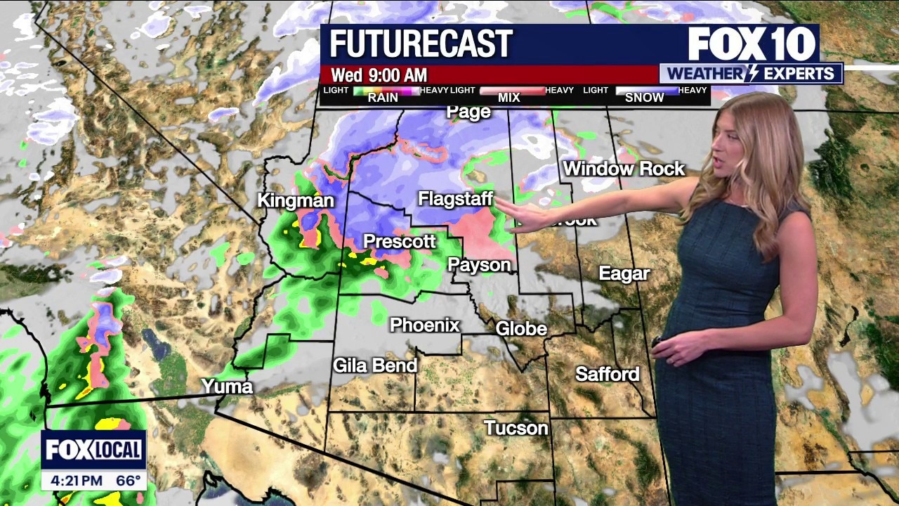
More Rain on the Way:
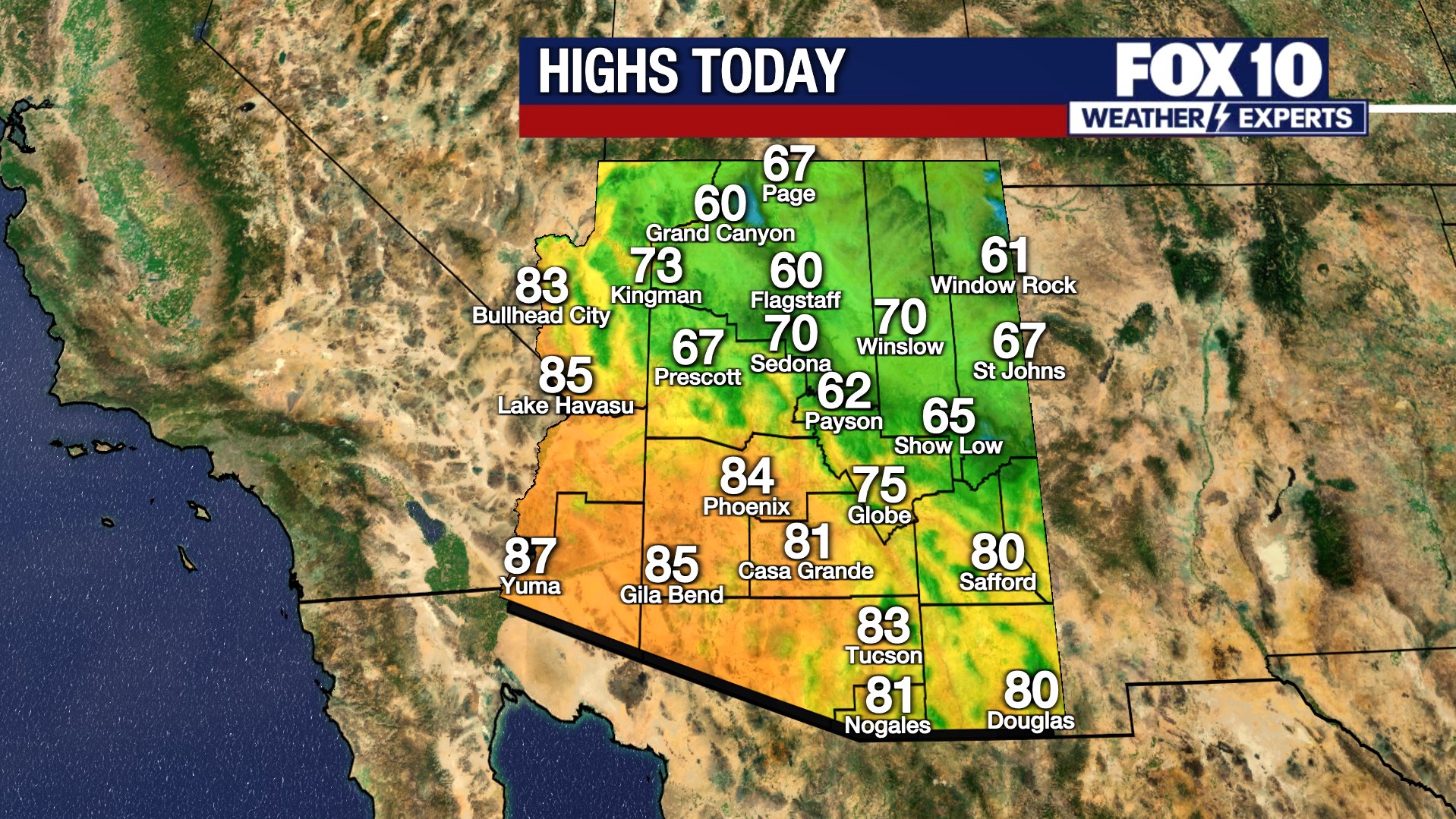
A second storm will impact Arizona on Wednesday, bringing rain, snow and extreme winds. Temperatures will stay cool in Phoenix, with a high around 65 degrees.
There is a chance for light rain showers in the northern and eastern Valley from mid-morning through the afternoon, but much of the Valley will stay dry Wednesday.
It will be a different story for the high country, with heavier rain and snow expected, starting in the morning, and lasting into the evening. Winter storm watches and winter weather advisories will be in effect all day for the Mogollon Rim, Grand Canyon Country, the Bradshaw Mountains and Four Corners. 6 to 8 inches of snow will be possible around Flagstaff down the Rim to Forest Lakes.
Winds will be extremely gusty in the high country, and high wind warnings are in effect Wednesday. 40 to 60 mph wind gusts are expected. The Valley will be gusty as well, with 30 to 35 mph wind gusts. The wind in the high country will cause low visibility due to blowing and drifting snow. Driving conditions will be very hazardous, especially in the Munds Park, Flagstaff, Williams and Happy Jack areas.
The Rest of the Week:
Thursday will be a quieter day, but another storm will bring more snow and rain to the state Thursday night to Friday morning.
You can always check the latest weather conditions by visiting the FOX 10 Phoenix weather page, or download the Free FOX 10 Weather app, which is available on Apple iOS and Android.
Scroll down this page for satellite and radar, day planner, records, current temperatures, 10-day forecast, forecast highs, and recent rainfall totals, plus live video feeds.


Road Conditions
- Call 511 anywhere in Arizona or 1-888-411-ROAD (7623)
- az511.com
Leave prepared before heading north
After recent snowfall in the high country, the Arizona Department of Transportation is reminding drivers who are heading north to never park along highways to play in the snow.
Use the highway shoulders for emergencies only. Parking on them to play in the snow is hazardous in the following ways:
- Other drivers may be distracted by your vehicle.
- Other drivers may pull over as well to play in the snow, compounding the problem.
- Your vehicle may interfere with first responders who need to use the shoulder.
- Plows can throw snow and ice far off highways.
- It’s much safer to re-enter highways from on-ramps and other designated entrances
"Also, it’s not uncommon for lots of desert dwellers to take the opportunity to head north to play in the snow. So, remember to pack your patience and expect to spend extended time in your vehicle getting to and from snow play areas."
ADOT's suggestions for items to take along:
- Warm clothing and blankets
- A fully charged mobile phone and charger
- Flashlight with extra batteries
- Drinking water
- Healthy snacks
- First-aid kit and necessary medications
- Ice scraper
- Small bag of sand or kitty litter for wheel traction
- Small folding shovel for snow removal
- Travel tool kit and battery cables
- Safety flares
- Plastic bags or containers for sanitation
- Road map(s)
ADOT says you and your vehicle must be prepared for driving in wintry conditions, including snow, ice and freezing temperatures.
- Get plenty of rest
- Plan your route in advance and notify someone about your route, destination and arrival time
- Take frequent breaks from driving
- Make sure your fuel tank is at least half to three-quarters full at all times
- Use snow tires, chains or studded tires as recommended or required. Studded tires are permitted on Arizona highways from Oct. 1 to May 1.
- Ensure your wipers, window defroster, headlights, taillights, brake lights and turn signals work
- Change your motor oil to a winter grade
- For electric or hybrid vehicles, be sure the battery has sufficient voltage and the connection cables are tight
Get more safety tips at https://azdot.gov/KnowSnow
For Flagstaff area snow-play locations, see FlagstaffArizona.org's Winter Recreation Map or call 844-256-SNOW.
Rain/flood safety tips
The American Red Cross' tips for heavy rain situations and flood safety:
- Turn around don’t drown! If you must drive and you encounter a flooded roadway, turn around and go another way.
- If you are caught on a flooded road and waters are rising rapidly around you, get out of the car quickly and move to higher ground.
- Tune in to your local radio, NOAA radio, or news channels for the latest updates.
- If your neighborhood is prone to flooding, be prepared to evacuate quickly.
- Follow evacuation orders and do not attempt to return until officials say it is safe.
- If power lines are down, do not step in puddles or standing water.
- If power is out, use a flashlight. Do not use any open flame as alternate lighting.
Preparing for a severe thunderstorm
The American Red Cross' tips for preparing for a severe thunderstorm:
- Put together an emergency kit.
- Know your community’s evacuation plan.
- Create a household disaster plan and practice it.
- Purchase a battery-powered or hand-crank radio
- Discuss thunderstorm safety with members of your household. Be aware that a thunderstorm could produce flooding.
- Pick a safe place in your home for household members to gather during a thunderstorm. This should be a place where there are no windows, skylights, or glass doors, which could be broken by strong winds or hail and cause damage or injury.
The Source: Information for this story was gathered from the FOX 10 Weather Experts.