

NHC: Tropical Storm Dolly forms in the Atlantic
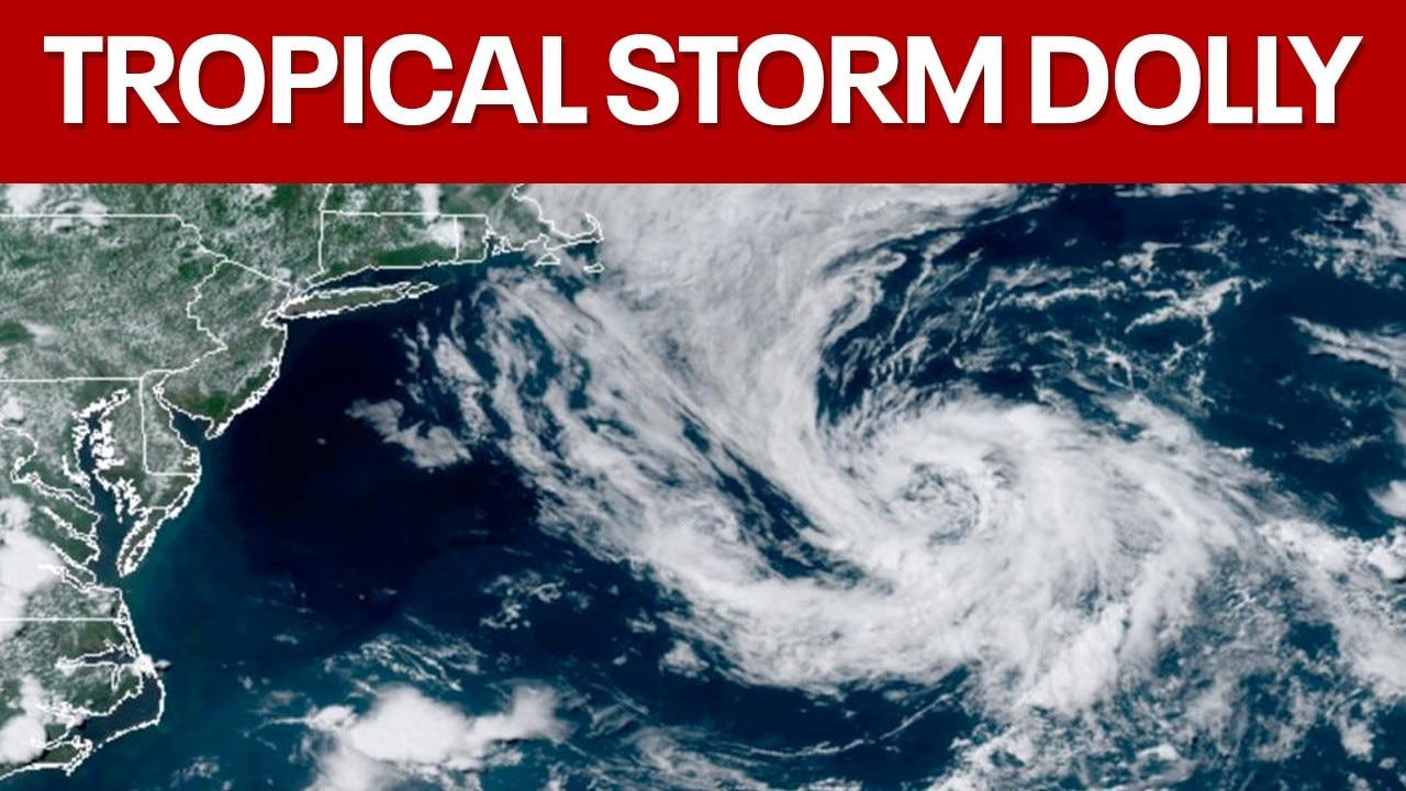
Tropical Storm Dolly forms in the Atlantic Ocean
The National Hurricane Center confirmed Thursday morning that Tropical Storm Dolly has officially formed in the Atlantic, marking the fourth named storm of the 2026 season. FOX 35 Storm Team Meteorologist Brooks Garner joined Hayden Wiggs to break down what Floridians need to know.
Tropical Storm Dolly has formed in the Atlantic, becoming the fourth named storm of the 2026 Atlantic Hurricane Season.
Tracking Tropical Storm Dolly
What we know:
The NHC said in its 11 a.m. update that Tropical Storm Dolly was 1,555 miles east of the Leeward Islands, traveling west at 24 mph. Sustained winds were estimated to be 40 mph.
Dolly is not expected to strengthen over the next 48 hours, and is forecast to downgrade to a tropical wave by the weekend, the NHC said.
Any impacts to Florida?
No immediate impacts to the U.S. or Florida. However, because Tropical Storm Dolly is still so far away, the official track and path is not certain.
When does hurricane season end?
The Atlantic hurricane season runs every year for six months, June 1 - November 30.
The most active months are typically between August, September, and October. The Atlantic season actually has two peaks: mid-September and mid-October, though activity tends to drop quickly after the second peak.
No, Tropical Storm Dolly was not named after Dolly Parton. Here's how the names get picked.
No, Tropical Storm Dolly was not named after Dolly Parton, the beloved country legend and humanitarian who died this week in Nashville, Tenn. after a brief battle with cancer.
There are 21 storm names issued ahead of every hurricane season – and they rotate every six years. That means the 2026 hurricane names will again be used in 2032, according to the National Hurricane Center.
The names are used to help track multiple storms being monitored during the season, especially if two or more storms develop at the same time, as well as to help keep clear communication between government agencies, meteorologists and forecasters, and the public about a specific storm.
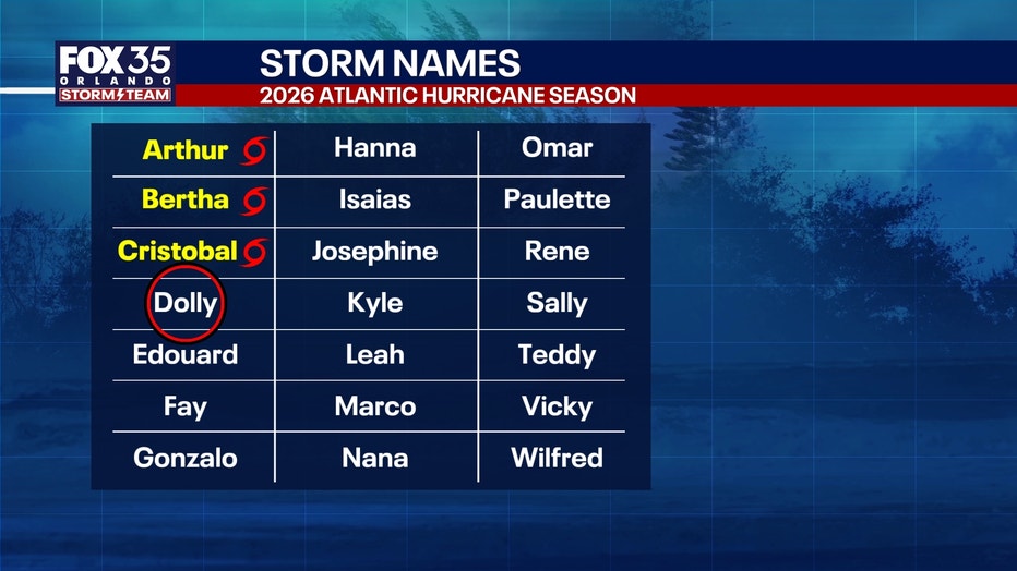
Who picks the hurricane storm names?
The hurricane storm names are decided by an international body of forecasters and the World Meteorological Organization. They are used to help meteorologists, forecasters, journalists, and the public communicate warnings and updates about a specific storm.
"Assigning names to tropical cyclones makes tracking and discussing specific storms more straightforward, especially when multiple storms are active simultaneously. Naming also helps to avoid confusion among meteorologists, media, emergency management agencies and the public," the WMO said on its website.
There are four factors considered when coming up with the names:
- Short in character length for ease of use in communication
- Easy to pronounce
- Appropriate significance in different languages
- Uniqueness – same names cannot be used in other regions.
The Source: The National Hurricane Center posted on X that it would initiate advisories regarding Tropical Storm Dolly.