

Arizona weather forecast: Hurricane Priscilla bringing heavy rain to the state

Evening weather forecast - 10/8/25
More rain is coming to Arizona this week, as the remnants of Hurricane Priscilla start to arrive. FOX 10's Erica Horvatin has this evening's forecast, and a look ahead to the increasing storm chances.
PHOENIX - One more day of warmer than average temperatures as moisture starts to move into Arizona. A flood watch will be in effect for northern Arizona Thursday through Saturday.
Today:
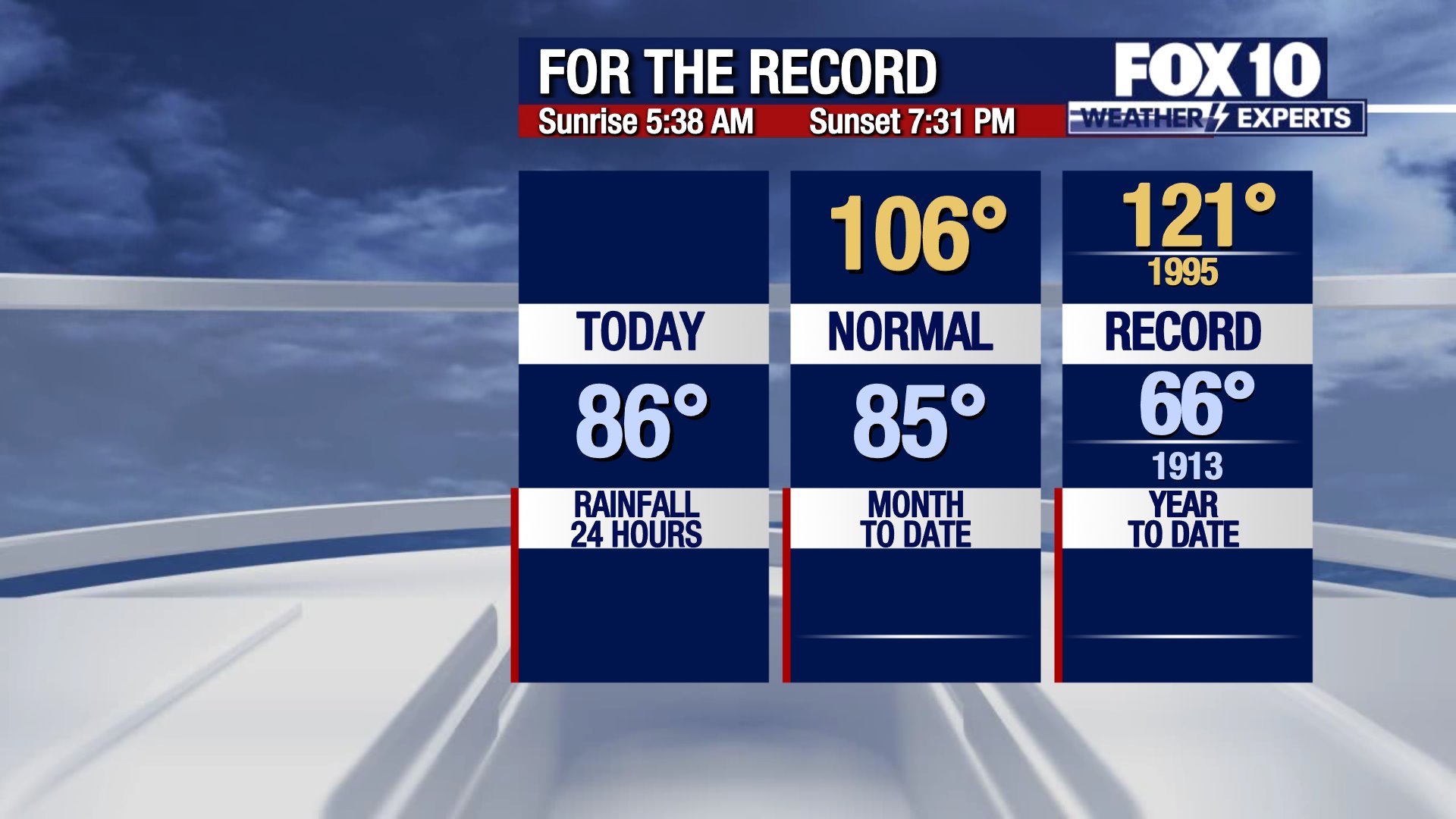
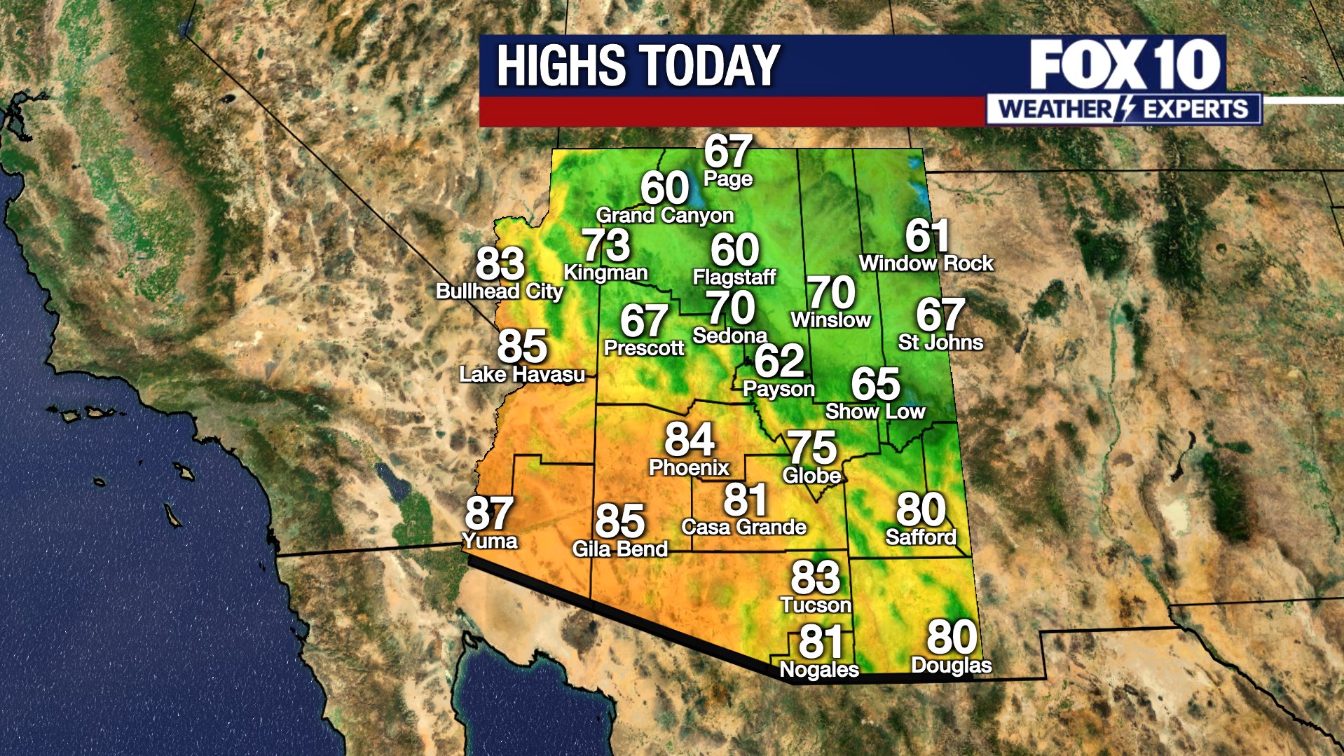
On Wednesday afternoon, the forecast high in Phoenix climbs to 100 degrees, with partly cloudy skies. The average high for the date is 92 degrees.
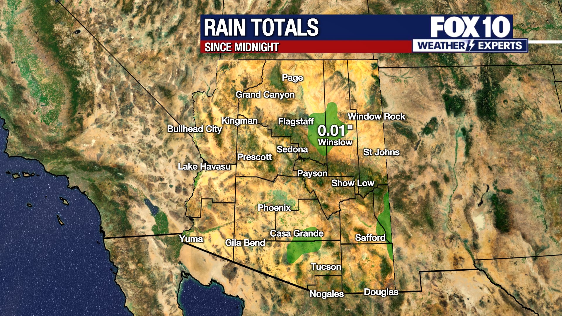
Shower and thunderstorms moved through eastern Arizona, and those areas will dry out by around midnight. However, more rain will move in from the south after midnight.
Tomorrow:
The showers are forecast to be scattered across the state, light to steady in intensity.
Scattered showers and weak thunderstorms will move north into Arizona during the early morning. Rain will be on and off throughout the day and evening. Be sure to grab your rain jacket or umbrella as you head out the door! Temperatures will start at around 79 degrees Thursday morning and will climb to around 93 Thursday afternoon.
Later This Week & The Weekend:
Rain will likely continue to lift south to north over the state into Friday, with additional rounds of showers lifting through the state into the afternoon and evening. At times, heavy pockets of rain will be possible, but the best chance for more widespread steady to heavier rain will be on Saturday and into Sunday. By Sunday afternoon, some of the heaviest rain may be focused over southeastern Arizona.
The flood watch will be in effect for the Valley, southern deserts, Superstitions, Globe and New River from Friday through Saturday. Flooding of rivers, creeks, low lying areas, urban areas with poor drainage and low water crossings is likely to happen.
Hurricane Priscilla:
All these showers are due to a favorable pattern driving tropical moisture from current Hurricane Priscilla up into Arizona. The early showers (Wednesday through Friday) are due to moisture building ahead of Priscilla's center. Rain chances increase into the weekend as the center of the remnant moisture from Priscilla toward the state.
An additional tropical system, which may become named, could potentially follow the path created by Priscilla and drive additional moisture into the state early next week, Monday-Tuesday.
This long-duration rain potential brings the possibility of flash flooding. While it's too early to pinpoint where the heaviest rain will fall with the highest totals (potentially over 2-3" of rain), model data is beginning to suggest southern Arizona could be at risk for some of the heaviest rounds. The exact track of Priscilla, which helps to determine its intensity, will determine who sees the largest amounts of rain. The next 1.5 days of movement will help provide some clarity on the weekend rain total potential.
You can always check the latest weather conditions by visiting the FOX 10 Phoenix weather page, or download the Free FOX 10 Weather app, which is available on Apple iOS and Android.
Scroll down this page for satellite and radar, day planner, records, current temperatures, 10-day forecast, forecast highs, and recent rainfall totals, plus live video feeds.


Rain/flood safety tips
The American Red Cross' tips for heavy rain situations and flood safety:
- Turn around, don’t drown! If you must drive, and you encounter a flooded roadway, turn around and go another way.
- If you are caught on a flooded road and waters are rising rapidly around you, get out of the car quickly and move to higher ground.
- Tune in to your local radio, NOAA radio, or news channels for the latest updates.
- If your neighborhood is prone to flooding, be prepared to evacuate quickly.
- Follow evacuation orders and do not attempt to return until officials say it is safe.
- If power lines are down, do not step in puddles or standing water.
- If the power is out, use a flashlight. Do not use any open flame as alternate lighting.
Preparing for a severe thunderstorm
The American Red Cross' tips for preparing for a severe thunderstorm:
- Put together an emergency kit.
- Know your community’s evacuation plan.
- Create a household disaster plan and practice it.
- Purchase a battery-powered or hand-crank radio
- Discuss thunderstorm safety with members of your household. Be aware that a thunderstorm could produce flooding.
- Pick a safe place in your home for household members to gather during a thunderstorm. This should be a place where there are no windows, skylights, or glass doors, which could be broken by strong winds or hail and cause damage or injury.
Road Conditions
- Call 511 anywhere in Arizona or 1-888-411-ROAD (7623)
- az511.com
The Source: Information for this story was provided by the FOX 10 Weather Experts.