

Potentially life-threatening blizzard pounds Northern Plains with historic snow, high winds

A late-season winter storm is pounding the Northern Plains with heavy snow and high winds and is expected to become a "potentially historic blizzard" for parts of North Dakota and eastern Montana.
This blizzard is part of the same storm system responsible for the ongoing severe weather outbreak across the Plains, Midwest and South.
As much as 47 inches of snow has piled up near Pony, Montana, since Monday, while up to 16 inches has been measured to the east in New England, North Dakota.
Billings, Montana, saw the snow fall at 2 to 3 inches per hour on Tuesday and tallied 13.9 inches for the day, making it the city's snowiest April day since at least 1955. This was also the first time Billings picked up at least a foot of snow in a two-day period since Feb. 23-24, 2014, when 12.8 inches piled up.
Blizzard conditions were observed in many parts of North Dakota on Tuesday afternoon and evening, including in the Bismarck and Grand Forks areas.
No Travel Advisories remain in place across much of North Dakota on Wednesday, as heavy snow and high winds will persist into Wednesday night.
The dangerous combination of snow and wind will cause blowing and drifting snow, making driving conditions extremely dangerous and even life-threatening at times. This includes Interstate 94 between Fargo, North Dakota, and eastern Montana.
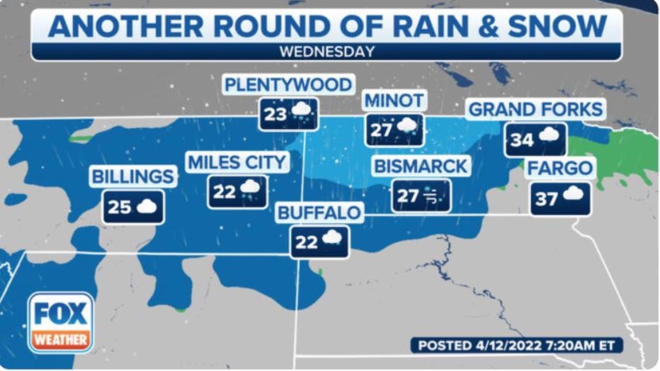
Forecast for Wednesday, April 13, 2022. (FOX Weather)
Snow and gusty winds will linger into Thursday before this winter storm finally winds down Thursday night.
Blizzard Warnings remain in effect through Thursday from eastern Montana to much of North Dakota and northwestern South Dakota.
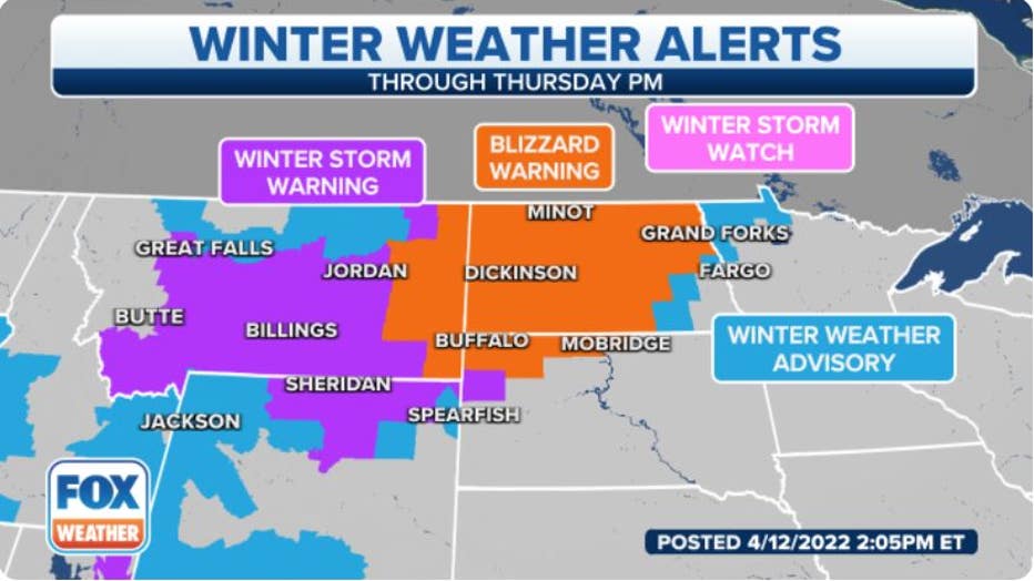
Current winter weather alerts.(FOX Weather)
According to NOAA's Weather Prediction Center, this winter storm is likely to develop into a "potentially historic blizzard" for portions of the Northern Plains, particularly where Blizzard Warnings are posted.
That's because if current predictions hold, cities such as Bismarck and Minot in North Dakota could experience their biggest snowstorm on record, despite the fact we're in the middle of April.
This storm even has the potential to break the North Dakota state record for the greatest three-day snowfall. The current record is held by Lisbon, which picked up 35 inches from Feb. 13-15, 1915.
Any unprotected livestock, particularly the young, will likely be killed due to the extreme impacts of this blizzard in the Northern Plains.
By the time the storm ends on Thursday, widespread snowfall totals between 1 and 2 feet are expected from eastern Montana to much of North Dakota, with the potential for 2- to 3-foot totals in some locations. Additionally, snowdrifts up to 6 feet high are possible.
Power outages and tree damage are also expected because of the combination of high winds and the weight of the heavy, wet snow.
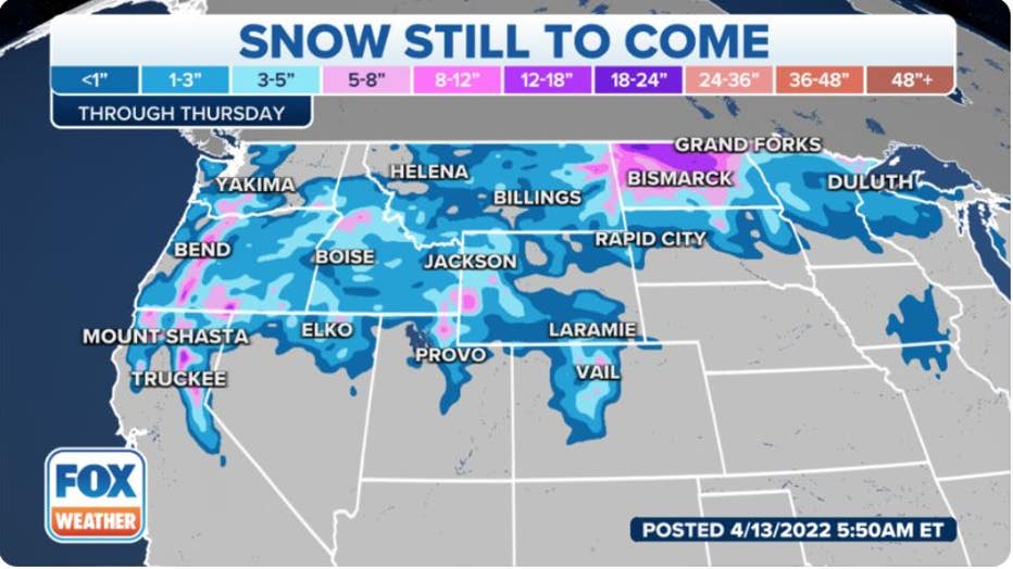
Additional snowfall forecast through Thursday, April 14, 2022.(FOX Weather)
While it is not unusual to get snow in April in these areas, it is getting late in the season for such a widespread event. Be prepared for major travel disruptions until the winter storm finally exits the region on Thursday night.
Before arriving in the Northern Plains, this system's snow swept across portions of the West on Monday, even accumulating at very low elevations such as Portland, Oregon, where measurable snowfall (at least 0.1 inches) was reported for the first time on record during the month of April. Officially, 1.6 inches was measured in Portland.